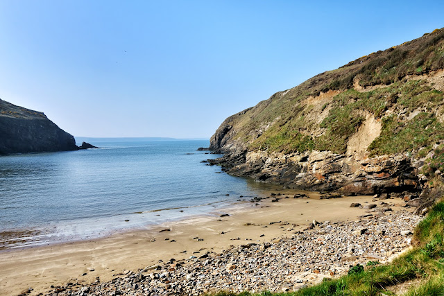
Wednesday, 22 April 2015

A trip to Skomer

Today a trip to Skomer! We boarded the 11am ferry with 15 or so other passengers for our short 10 min crossing, the sea being really calm. On the approach to Skoma we saw Puffin in large numbers flying around, or just swimming in groups on water.
After a short talk by the Wardens, we were off to see what we could see toward the center of the island, photographing the trigpoint on the way and walked toward The Wick.
This was the area that we saw the most puffins in their burrows – brilliant. While strolling along this area we also saw choughs flying around.
We stopped and had our picnic lunch and continued before deciding to head back through the centre toward the old 19th century farm buildings and the landing stage in hope more puffin pictures Saw some on the water only, but great walk anyway.
The boat very crowded on way back but it was only a short journey. All in all, a great trip and well worth doing.


Trig point on Skomer marking its height above sea level at this point of 79.357 m


What would a trip to Skomer be without a picture of a Puffin?

These delightful birds with their brightly coloured bills are part of the largest colony of puffins in Southern Britain. Each year around 6,000 of them return to spend the spring and summer on Skomer.
Puffins arrive on Skomer in late March, but don’t immediately settle down on the island. Initially they collect in rafts at sea, as if to build up their confidence to storm the island. But soon they return to the cliff tops to re-occupy burrows where they will lay a single egg which will hatch in June. After, the birds can be seen flying into the island, with beaks lined with sand eels. By late July the birds depart the island and return to a life at sea. It is then that the brightly coloured bills, for which puffins are so recognisable, fade, to come to life again next spring.
Many people are surprised when they first see a puffin by how small they are, just 30cm from beak to tail. They also marvel at how relaxed they seem around visitors to the island, crossing the paths to reach their burrows, while navigating their way through feet and legs.
The day we arrived, many had gone fishing, but we managed to see several around their burrows.


Our boat returning to the mainland.


Harold`s Stone

The Harold Stone is an erect monolith, 1.7m high by 0.8m by 0.5m. It tapers from a broad base to a point, with its edges aligned nearly north-south; its wide face is orientated to face the sea to the east and the island to the west. It is one of several stones in south-west Wales bearing the same name. Gerald of Wales asserted that the stones were erected by Earl Harold to commemorate his victories over the Welsh in 1063. Although the Harold Stone on Skomer is currently undated, excavations at other similar stones in Pembrokeshire have always yielded a prehistoric, or Bronze Age, date. It is therefore safe to assume that this stone is also a Bronze Age monument, marking a burial (in a cremation urn) or an area of now concealed ritual and funerary activity.
It has be said that not everyone thinks it is that old – but it sounds good!


Lime Kiln on Skomer


Awaiting the boat from the mainland


Once back on the mainland, we moved a short distance to a car park closer to Marloes Sands where a walk revealed another Earthcache.
Marloes Sands is another stunning beach and the Earth Cache well worth seeing. It`s a 1.5 kilometres (0.93 mi) long remote sandy beach where the Earth Cache was situated. Not a soul in sight!


The Three Chimneys

Geologists journey here to this remote spot from all over the world to take a look at an exposed stretch of Silurian rocks known as The Three Chimneys – near-vertical beds of alternating sandstones and siltstones demonstrating different states of weathering. Geological Surveyors have carved in the rock a small arrow, not difficult to find, to mark where the Silurian rock ends and the Old Red Sandstone begins. This picture was proof of my visit to the Earth Cache.


Wild flowers galore this time of year.

The end of another lovely day - we definitely will come back to Skomer!


Home    Forward   Back

Tuesday, 21 April 2015

A Geocaching day in Pembrokeshire

Tuesday we decided to try and pick up a few local Geocaches and our first stop was for one at Nolton Haven, a pretty beach as usual. If you have never tried Geocaching follow this link for an explanation. As a worldwide treasure hunt, it is suitable for most ages, and is great fun - and addictive!


In the 19th century this was a busy port, as coal was exported from Nolton and nearby Newgale. It was a good easy cache to find.


Newgale – great surfing bay with beach berms (Piles of shingle / stones) 

Maidenhall was our next stop, where a great view from the car park viewpoint and another cache awaited. Well hidden in the wall. 
Then a short drive to Newgale with it`s great surfing beach and berms. Here, one earth Cache and two regular ones completed our tally before heading back to Broad Haven for a steak pie lunch – lovely! So, a berm, a dictionary definition is: A nearly horizontal plateau on the beach face or backshore, formed by the deposition of beach material by wave action, or by means of a mechanical plant as part of a beach recharge scheme. 
So, there you have it, a bank of stones piled high by the action of the waves, and quite a sight it was. To log the Earthcache, I had to send a picture of myself on top of a berm holding a large flat stone from the top of the berm. Plus, answering the question as to `why the largest stones were on the tops of the berms`. 


Musselwick beach 

After lunch, we headed down to Martin's Haven on the The Dale Peninsula to check on our intended trip tomorrow across to Skomer. One cache at Musselwick beach and another at Ye Olde Bridge on the way home, and that was it for the day. 


On the wall by Ye Old Bridge

So, a few Geocaches found and logged and another few of the amazing scenery viewed. Just reinforcing why this part of the UK is one of my favourites.

Home    Forward   Back

Monday, 20 April 2015

The Marloes Peninsula

The Marloes Peninsula coastal walk was our target for today.This walk starts near Marloes Sands and passes Marloes Mere, an area of wetland pools and marsh important for ducks and other wild fowl. Hen harriers and short-eared owls can often be seen quartering the marsh, not that we saw any I am afraid. After passing an impressive Iron Age fort, the route joins the Coast Path. It stays just inland from the cliff tops, but offers great views of the coast and the islands of Skokholm, Skomer and guano covered Grassholm in the distance. All three are home to important seabird colonies in the summer. The walk crosses coastal fields which are managed to encourage chough, something that we did see, and watched, for a considerable time – magic!
Finally arriving at the Deer Park with spectacular views of Skoma and then onto Martin's Haven, the embarkation point for Skomer. 


Islands seen from the Marlos Coastal footpath


The caterpillar of the Oak Eggar (Lasiocampa quercus) moth.


Could not resist the pink sea at this point.


Was I pleased to get this ? – a Chough – and with a compact RX100 camera!

While its black plumage identifies it as a crow, the chough (pronounced ‘chuff’) has a red bill and legs unlike any other member of the crow family. It has a restricted westerly distribution in the British Isles and because of its small population size and historically declining populations it is an Amber List species. It readily displays its mastery of flight with wonderful aerial displays of diving and swooping. Found in flocks in autumn and winter.


Martin`s Haven which is the embarkation point for the isle of Skomer.


Nolton Haven - A really beautiful area to walk, and places to explore. No wonder people want to return here year after year. So many lovely beaches in this part of the world, although photographically, they look the same, they are beautiful!

Home    Forward   Back

Sunday, 19 April 2015

Solva and St David`s Head

Sunday saw us drive the coastal road to Solva. On the way passing Newgale and it's great surfing beach and massive pebble beach called a BERM – a term I had never come across before. We will return to have a closer look another day. Then a return visit to the lovely sheltered harbour of Solva where we went for short 2 mile walk followed by a hearty lunch at the Ship pub. After lunch, on through St Davids to Whitesands beach and a walk around St David’ Head. Stunning beach and walk – very weary on finishing as the ground was quite rough, but well pleased with ourselves..


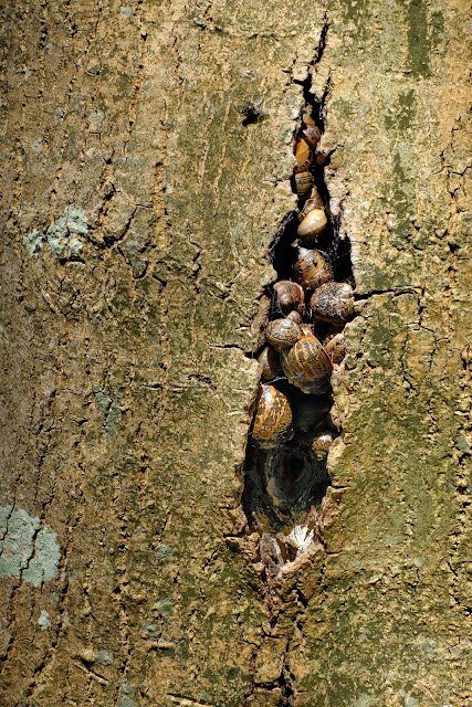
Looks cosy to me! as snails crowd into a crack of a tree.


Gorgeous coloured leaves emerging on the coastal path.


Lime kilns on Solva beach

Limestone would have been brought in by boat and heated in these kilns to produce the lime mortars that Newport’s stone built houses would have been constructed with, they would also have been lime washed (a quicklime and water mix) on a regular basis to protect them from the elements.
A temperature of some 900-1000°C would have been required in the kilns to create the reaction that turns the limestone into quicklime. The lime kilns would have been loaded with intermittent layers of coal and limestone and from start to finish a time scale of some seven days would have been required to produce a batch of quicklime.
This was a dangerous and very strenuous job but the benefits when applied to acidic soil were, and still are, enormous.


The entrance to Solva harbour


This way please!


Mind you don't get your feet wet. On route round the Solva walk.


A secluded beach near St David's Head


Whitesands beach, a bit bright as I was shooting into the sun, but I had to get a picture!


Home    Forward   Back

Saturday, 18 April 2015

Arrival in Broad Haven

We found the cottage, which is a part of a converted farm building, in a gloriously quiet area, just up from Little Haven. We are opposite the owners farmhouse, and it's idyllic!


Our holiday cottage in Broad Haven


... and part of the garden, leading to some woods.


One wind bent tree seen one late afternoon in the woods near our cottage 


Looking across Broad Haven beach from the war memorial. 

Saturday, our first full day, we took a walk from Broad Haven, near to where we were staying, to Little Haven – along the coastal path and back by the beach. Followed up with a really good fish & chip lunch. After lunch, a short drive north of Broad Haven beach and a walk back along the coastal path. Three Geocaches found for the day, including one Earth Cache. Not bad. 


Broad Haven beach with ripples left by the retreating tide. 


One of several caverns cut into the cliffs along this coast – this one was called the Foxhole I think 


Found on the beach near Little Haven, and left by the retreating tide. 


Great contrast between the blue sea and the stunning hedges of Gorse. 


Home    Forward   Back

Wednesday, 25 February 2015

Hunstanton and Snettisham in Norfolk

One of the most eye catching things about Hunstanton in Norfolk, are the cliffs. The best time to see them is in a late evening summer evening - and we had just such conditions for these images.


The famous red and white striped cliffs are an eye-catching attraction. Why are the cliffs striped? The stripes in the cliffs are caused by layers of different coloured rock. The main layers are Carrstone and also Chalk. 
Carrstone is the brown layer and consists of sandstone - sand cemented together by iron oxide (rust). In places where the cement is stronger, the rock is darker and less crumbly. There are no fossils in this layer apart from a little fossilised wood. 
The red and white chalk is made of limestone. Limestone forms in warm tropical climates, which suggests that Hunstanton climate was once warmer than it is today. The colour of the red chalk is due to iron staining.


Patterns in the sand, made as the sea retreated.


On the famous cliffs is the imposing Hunstanton Lighthouse. A lighthouse has been here since 1665, but the present lighthouse was built in 1840, although it ceased operations in 1922 and became a private residence.
The wall is generally referred to as the Chapel of St Edmund. It existed in 1272 but was already a ruin by the Reformation. What survives is basically the south doorway, apparently Norman. You can make out the outline of the south wall of nave and chancel.
More dramatic is the lighthouse beyond it. I tried taking the photograph with the lighthouse beside the ruin, and then with the lighthouse through the south doorway - this is my effort above.


St. Mary's Church in the village of Snettisham has a 14th-century, 172-foot (52 m) high spire. Claimed by some to be "perhaps the most exciting decorated church in Norfolk".
It is certainly striking as you approach it. As it was locked, and is most of the time apparently, we did not get a chance to see inside.


Billy Goat Gruff - what a beard!


And last, a deer giving us a close up look, in the hope of food.


Home    Forward   Back

Monday, 24 November 2014

Lots of water in Layham

After a period of heavy rain - again, the area had some great puddles and small flooded areas to wade in!. So Izobelle and Nanna made the most of the situation.


On my way to see the water.


Not so sure! 


Maybe it's OK


Home    Forward   Back

Featured post for the week

Bridges and butterflies in Pipers Vale, Ipswich

Ipswich is blessed with a number of park areas, including the great Christchurch Park. The Park we visited today is called Piper`s Vale, and...