Showing posts with label orchid. Show all posts

Wednesday, 27 July 2016

The deserted village of Wharram Percy

Wharram Percy is a deserted village in a beautiful, secluded location in the Yorkshire Wolds. The village is the most extensively studied of all deserted medieval villages in England. Excavations at Wharram Percy took place every year between 1950 and 1990 and reveal the rich history of the village and why it was eventually deserted.
The village was first settled in the Bronze Age, though the first dwellings of which we have records date from the Iron Age, when two houses were established. By the Roman period there were five farm sites here, and finds of Roman tiles and tesserae indicate the presence of a Roman villa nearby.


There was further settlement in the Saxon period and a corn mill stood here by the 9th century. A small chapel stood on the site of the current church in the 10th century. 
From the 12th century there were two manors at Wharram Percy, known to archaeologists as North Manor and South Manor, the latter owned by the powerful Percy family. The Percy's later obtained the North Manor as well. 
The village declined after the onset of the The Black Plague of 1348-50, and by 1368 there were 30 cottages and a corn mill. In 1403 the final decline began when the Hilton family of Sunderland bought the manor and began to convert farmland to sheep pasture. This process continued throughout the 15th century and by 1500 the final four families were evicted and their cottages demolished. 
The final stage of Wharram Percy's history came in the late 18th century, when Sir Charles Buck built a new farmhouse and farm buildings. 
The only remaining buildings are the ruined church and the farmhouse built by Buck. On a slope above the church are the foundations of over 30 medieval farm cottages. The outline of the cottages is clearly visible and there are very good information panels which inform visitors about the village layout and archeology. Beside the church is a quiet mill pool. 


The location is superb, set low in a valley with wooded hill on one side and a broad slope on the other. Come in the evening and the only sound you hear is the lowing of cattle from neighbouring fields and the sound of doves cooing in the trees that cluster around the village site. 
St Martin’s Church evolved through six phases between the early 12th and early 17th centuries. Following the collapse of the tower in 1959, the interior of the church was excavated, revealing a smaller, mid-11th-century stone church and a mid- to late 10th-century timber antecedent. 
Four successive vicarages stood nearby between about 1327 and the 1830s. A medieval barn, the outline of which is displayed, was extended to adjoin the earliest vicarage in 1536. When both burned down in 1553, the vicarage alone was rebuilt. It was replaced in the mid-17th century and again before 1764. The outline of the excavated ground-floor rooms of this last vicarage can be seen to the north of the church. 


Home    Forward   Back

Saturday, 21 June 2014

Back to Tobermory and onto Duart Castle

Another drive along the Sound of Mull to Tobermory today, but a slower pace with time to explore.


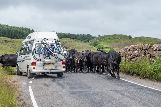
The locals decided that this would be a leisurely drive! That one in the front is coming straight for us Rosey!


This time we have a better day and the colours of the house stand out better. Lunch and a good stroll around was the order of the day.


These old vessels on the Sound of Mull looked great against the dark sky.


The village next to where were staying was called Inverlussa. So next morning we thought to take a stroll down the road and explore as we had a trip to Duart Castle planned for the afternoon.


Keeping an eye on the hedgerow as we walked, we spotted these Common Spotted Orchid, Dactylorhiza fuchsia


Then we found a grasshopper - not sure of the variety.


... and then my favourite of the morning, a Fritillary butterfly


Quickly followed by a Cinnabar moth.


Then we came across a monument to Dugald MacPhail (1818-1887) He was a Gaelic songwriter, poet and author. Born at Strathcoil on Mull in the Inner Hebrides, MacPhail worked as a joiner and architect. He moved to Glasgow with his young wife, and then to Newcastle (England) where he wrote the song An t-Eilean Muileach (The Isle of Mull), for which he is best remembered. This is now known as 'Mull's National Anthem'. He was appointed architect and clerk of works to the Duke of Westminster, which brought a move to Shaftesbury, where several of his family were born. He then moved to Edinburgh, being attracted because of the educational advantages that city brought to his family. 


In the afternoon we drove a short way to see some Highland dancers perform at Duart Castle. This was a matter of a few minutes drive from our holiday cottage.
Duart Castle proudly guards the sea cliffs of the Isle of Mull, while enjoying one of the most spectacular and unique positions on the West Coast of Scotland. Brought back from ruin in 1911, the Castle treasures 800 years of history of one of Scotland’s oldest Clans, The Macleans, and is one of the last surviving privately owned Clan Castles in Scotland.


It was very enjoyable to see real Scottish dancers, and in the great surroundings.


So, at the end of the day, what sort of sky do we have from the kitchen window?


Home

Friday, 20 June 2014

Loch Spelve and otters

Located in the south-eastern ‘corner’ of Mull, Loch Spelve is a large tidal body of water bounded by an unclassified single track road which branches off at its western end with one track running back along the southern shores of the loch to Croggan and the main track running west to Loch Buie. Being just south of where we were staying, it looked a great place to explore.


Definitely an `unclassified single track road`! 


We had read of the otters being seen here. On arriving to park, we were cruising along the Loch side when we spotted a woman, loaded with camera gear coming toward us. On speaking to her, it transpired that she and her husband (both keen photographers), were in the area photographing otters. Soon afterwards she caught our attention and we followed her along the loch as an otter went about his business on the loch side. Magic! 


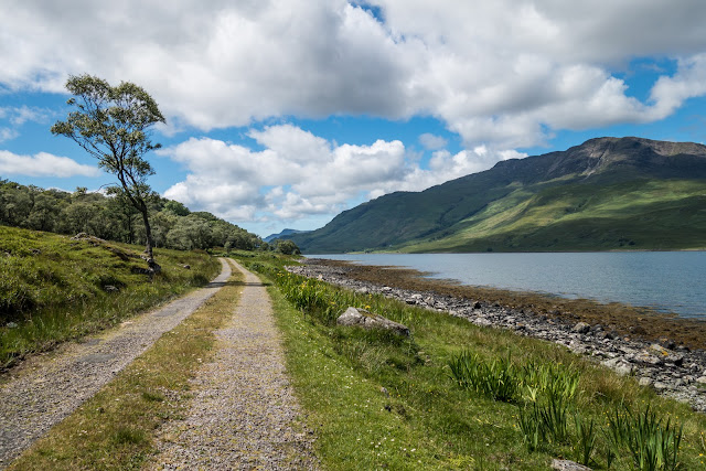
Another view of the lock and an interesting tree by the side 


Curlew on Loch Spelve shore


Oystercatcher by the loch


Was this an old highlanders house destroyed in the Highland clearances? 

To quote an article in the SCOTSMAN: 
THE HIGHLAND Clearances are an infamous chapter in Scottish history, the cruel story of how the Highland people were dispossessed of their homes by their landlords. So emotive is the subject that many writers denounce the clearances as the first act of modern ethnic cleansing. Yet, while economic forces did change the face of the Highlands forever, the clearances were not a single act of genocidal intent. The clearances largely took place between the 1770s and 1850s, although eviction struggles continued until the end of the 19th century, such as the Battle of the Braes in 1882. The end of the Highland way of life really began with the Jacobite defeat at Culloden in 1746, when the British government swiftly acted to break the resistance of the proudly independent Gaelic society. Highlanders could no longer meet in public or bear arms. The wearing of tartan, teaching Gaelic and even playing the bagpipes were outlawed by the 1747 Act of Proscription. The act was repealed in 1782, but by then a more grave set of threats to the old clan system had emerged: economic collapse and agricultural revolution. The Highland economy was based largely on subsistence farming and the export of cattle, as well as kelp from the coast used to make glass and soap. At the time, many landlords complained not that there were too many Highlanders but that too many were leaving, forcing the government to pass the 1803 Ships’ Passengers Act that tightened emigration laws. This situation changed radically as the cattle and kelp industries collapsed following peace with France in 1815. At the same time, the agricultural revolution began changing the shape of farming throughout Europe from small- to large-scale production. The early Highland Clearances occurred alongside the second round of enclosures in England, where small holders were forced to leave common lands. Further, the agricultural economy shifted as demand grew for sheep in the newly industrialising cities. Sheep became more desirable to some landlords than their Highland tenants. The most notorious of the Highland Clearances occurred on the estates of the Countess of Sutherland between 1811 and 1821. Riots in Sutherland in 1813 failed to dissuade the Countess from her desire to replace Highlanders with sheep. Many families were burned out of their home. A local, Donald MacLeod, reported that from a hill he saw 250 homes from one district ablaze. The fires lasted six days. In 1816, the Countess’s factor, Patrick Sellar, was acquitted by a court on charges of arson and culpable homicide. 


White Heath spotted orchid 


Fritillary butterfly 


Victoria Jubilee This pyramid shaped monument is also on the right hand side of the road alongside Loch Uisg – shortly after the Red Monument – and just before the end of the Loch. It is set beside the road, but is some 3 meters above the road level on a low bluff of rock. The plaque reads; “Erected by Lochbuie and his Highlanders to commemorate Queen Victoria’s Diamond Jubilee, 22 June 1897. God Save the Queen”


Lochbuie Post office - unmanned, with its honesty box in the image above. Not sure how that would work in many places!


To round off a very pleasant day, this was the view from our kitchen window in the evening.