Showing posts with label Pembrokeshire. Show all posts

Monday, 12 June 2017

Stackpole Estate clifftop walk

A `must visit` place in Pembrokeshire is the NT Stackpole estate which has some of the most stunning coastal views to be found anywhere. It’s difficult to imagine the many buildings that may have graced the Stackpole Court site over the centuries. Occupied since Norman times, the Stackpole Estate has seen its fair share of boom and bust over the centuries.
The Campbells built the early Georgian mansion of Stackpole Court in the Palladian style in the 1730s on the site of the earlier fortified house.
Two world wars heralded a century of decline at Stackpole. Half of the estate, around 6,000 acres, was requisitioned by the Ministry of Defence to form Castlemartin Range in 1938.
Sir John Campbell II inherited the estate in 1777 and began landscaping work on a grand scale. What was once a valley was later flooded to create the Bosherston Lakes, as part of a designed landscape, and thousands of trees were planted.
Thirteen years later, what was left of this historic estate was broken up and the farms were sold. Thankfully the coast, woods and lakes passed to the National Trust and were saved for the nation.


Stackpole Quay - the start of our walk


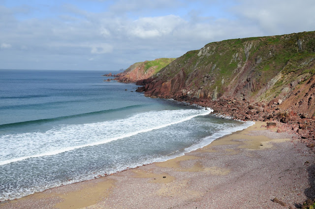
The first sight of Barafundle Bay and its magnificent sandy beach. Barafundle is a jewel of a beach set between limestone cliffs and backed by dunes and woods. This secluded bay can only be reached by a cliff path walk from Stackpole Quay, with steep steps at either end.


Looking back along Barafundle Beach.


The far end of the bay before you head into the trees to continue your walk.


More of the Stackpole coastline


Church Rock


And the small bay just beyond.


The famous Bosherston Lakes were created 200 years ago to provide a backdrop to Stackpole Court. Sadly, the house was finally demolished in 1963. The bridge is usually called the Eight Arch Bridge. I wonder why?
From the bridge we walked back toward Stackpole Quay and the chance to get a coffee and something for lunch. I believe that you can go on a slightly longer route than we did but ours was about 4 miles and was long enough for us today.

Sunday, 11 June 2017

Little Haven & Broad Haven

Pembrokeshire is one of our favourite places in the UK, and the small island of Skomer off the coast with it's amazing wildlife, an obvious attraction. So, with this in mind we booked a cottage in Little Haven which is an area we have stayed in before, and is not too distant from the embarkation point for the island. The weather did not look to promising when we arrived and was not much better on the Sunday, resulting in the cancellation of the ferry. Monday is a rest day which left us with fingers crossed for our last day of tuesday!


Little Haven as we walked down the hill toward the village from our holiday cottage.


On Broad Haven beach but not sure what this gate is for!


Little Haven beach - such crowds!


Some patterns in the sand.


Settlands Beach and flowers taken on the path above as we walked between the two Havens. I just loved the colours against the fluffy clouds in the blue sky.


Rosey contemplating the empty beach, and some colours in stones. It is amazing how many colours can be seen in stones piled on beaches.

Home    Forward     Back

Thursday, 23 April 2015

Stackpole Estate - my first visit

A `must visit` place in Pembrokeshire is the NT Stackpole estate which has some of the most stunning coastal views to be found anywhere. It’s difficult to imagine the many buildings that may have graced the Stackpole Court site over the centuries. Occupied since Norman times, the Stackpole Estate has seen its fair share of boom and bust over the centuries. The Campbell's built the early Georgian mansion of Stackpole Court in the Palladian style in the 1730s on the site of the earlier fortified house.
Two world wars heralded a century of decline at Stackpole. Half of the estate, around 6,000 acres, was requisitioned by the Ministry of Defence to form Castlemartin Range in 1938.

Sir John Campbell II inherited the estate in 1777 and began landscaping work on a grand scale. What was once a valley was later flooded to create the Bosherston Lakes, as part of a designed landscape, and thousands of trees were planted.
Thirteen years later, what was left of this historic estate was broken up and the farms were sold. Thankfully the coast, woods and lakes passed to the National Trust and were saved for the nation.


Stackpole Quay

Today we intended to walk the remains of a once grand Stackpole Estate. We started near Stackpole Quay, a small harbour nestled in amongst the cliffs which is a favourite venue for kayakers who can be seen bobbing up and down exploring the caves and cliffs nearby.
Then onto Stackpole Head itself, a stunning piece of coastline with the amazing Stackpole towering cliffs with bird life in abundance nesting on it`s ledges.
Further along we came to Barafundle bay – a small bay backed by dunes and pine trees.
Then we reached Broadhaven South beach and before turning toward the lakes of the Stackpole estate, over the Eight Arch bridge picking up a cache and eventually arriving back at our car park.
Sandwich, cake and coffee at The Boathouse was a great finish to a stunning walk.


The rugged coast near Stackpole Head

Stackpole Head where the sea has sculpted stacks, caves, arches, inlets and headlands, and where razorbill, guillemot, chough, peregrine and raven live. Unfortunately the tide was high at the time we did our walk but from the top it was still dramatic to say the least.


Rosey photographing Gannets nesting on the ledges of Stackpole Head and Stackpole Headland itself, one of the most spectacular parts of this walk


Barafundle Bay

Barafundle Bay – a small bay backed by dunes and pine trees, accessible only by a half mile walk from the nearest car park. Swathes of golden sand and crystal clear waters, Barafundle has been voted many, many times as one of the best beaches in Britain and the world; it’s often likened to a Caribbean beach! This pristine beach is isolated which means no facilities; so everything you take has to come back up over the cliffs.


A large jellyfish stranded on the sands at Barafundle bay


Church Rock - I guess it looks a bit like one.


The Eight Arch Bridge on the Stackpole Estate is a grade II listed construction.. It is owned and maintained by the National Trust.
The bridge was built in 1797[2] to connect Stackpole Court and Home Farm to Stackpole Quay and the New Deer Park. At some point face-to-face iron ties were added to hold the bridge together.
On 2 August 1996 it was listed by Heritage in Wales (now Cadw) as grade II for its eye catching nature as a major feature of Stackpole Park, and as part of the Stackpole group of buildings.
The bridge is built over a weir between two ponds (part of the Bosherston Lily Ponds). There are eight segmental arches in limestone, one with slightly projecting keystones. The arch rings are in ashlars; the rest of the arches in common stonework. There are a low rebuilt parapet walls, with slight wing walls at each end, on either side of the 3.3-metre (11 ft) roadway.


There is a series of interconnecting lakes, created at the turn of the 19th century by Baron Cawdor, once the owner of the Stackpole Estate. He dammed a small tidal creek which then flooded the three tributary valleys. Subsequent drifting of sand has created a large marram grass-covered dune system behind the beach. The lakes are abundant in wildlife, with herons prowling the shallows, swans, ducks, moorhens and coots all easily visible on the surface, and shyer creatures such as kingfishers often spotted. The Lily Ponds, which are made up of the two westerly fingers, are managed as a National Nature Reserve, and the lilies themselves are at their best in June, while the woodland is a magnificent spectacle in spring and autumn.
Well, all good things come to an end, so promptly the following morning we pointed our car east and headed for home.


Home    Forward   Back

Saturday, 18 April 2015

Arrival in Broad Haven

We found the cottage, which is a part of a converted farm building, in a gloriously quiet area, just up from Little Haven. We are opposite the owners farmhouse, and it's idyllic!


Our holiday cottage in Broad Haven


... and part of the garden, leading to some woods.


One wind bent tree seen one late afternoon in the woods near our cottage 


Looking across Broad Haven beach from the war memorial. 

Saturday, our first full day, we took a walk from Broad Haven, near to where we were staying, to Little Haven – along the coastal path and back by the beach. Followed up with a really good fish & chip lunch. After lunch, a short drive north of Broad Haven beach and a walk back along the coastal path. Three Geocaches found for the day, including one Earth Cache. Not bad. 


Broad Haven beach with ripples left by the retreating tide. 


One of several caverns cut into the cliffs along this coast – this one was called the Foxhole I think 


Found on the beach near Little Haven, and left by the retreating tide. 


Great contrast between the blue sea and the stunning hedges of Gorse. 


Home    Forward   Back

Tuesday, 4 May 2010

Exploring St Annes Head

St Anne`s Head protrudes from the bottom of Pembrokeshire - if you excuse the expression! This was the area we had decided to explore today, starting on the left side at Westdale Bay and making our way along the coast in an anti-clockwise direction. As with most bays and inlets, there was hardly another soul about.


Westdale Bay - not a soul in sight.


Wheatear sitting by the fence.


Around the area of Frenchman's Bay with the beautiful rock formations.


Wonderful rock formation at St Anne`s Point


St. Ann’s Head Lighthouse was built in 1844 to guide shipping bound for Milford Haven, replacing two leading lights established in 1714.
Trinity House approved in principal a private application to build a coal-fired light at St. Ann's Head in the second half of the 17th century to guide Milford-bound shipping; it was to be supported by voluntary payment of dues. However, the owners extracted dues illegally from shipowners and the light—the only one on the west coast—was discontinued. 40 years passed before another light was established although it is said that sea traders petitioned many times for the area to have lights.
On 15 March 1712 a patent was granted to Trinity House to build a lighthouse at St. Ann's Head. Trinity House in turn—as was its policy at the time—leased it to the owner of the land, Joseph Allen, who agreed to build two lighthouses and keep them in good repair. The terms of the lease were for 99 years at an annual rent of £10; to help maintain the lights, Allen was permitted to collect dues from the shipmasters at Milford Haven amounting to one penny per ton of cargo on British vessels and two pence on foreign vessels. Allen established two towers near the old disused lighthouse and lit coal fires on them in June 1714. St. Ann’s Head Lighthouse was automated and de-manned in 1998. The lighthouse is now monitored and controlled from Trinity House’s Planning Centre in Harwich, Essex.


Henry Tudor’s landing site

Further around the coast we came across this plaque with an important piece of history on it. On 7 August 1485, Henry Tudor landed here at Mill Bay, at the mouth of the Milford Haven waterway. He was 28 years old and had lived most of his life in exile in France. With him were c.2,000 French mercenaries, funded by the King of France. Little more than a fortnight later, his supporters had defeated King Richard III at Bosworth, near Leicester, and he became King Henry VII. The Tudor dynasty which followed had a profound influence on Britain as we know it today. 
Why did Henry choose Mill Bay? Familiarity was one reason. Henry was born in Pembroke Castle, on the opposite side of the Milford Haven waterway. His uncle, Jasper Tudor, was nominally Earl of Pembroke and had maintained contact with people in the area while bringing up his nephew in France. 
Another reason for choosing Mill Bay was to avoid detection by the king’s observers at Dale Castle, some 3km further north. Inevitably, news of Henry’s landing travelled quickly – the king knew about it by 11 August. Crucially, however, the decision to land in this secluded bay allowed the fledgling army to come ashore unopposed. 
It was also imperative for Henry to start his march to Bosworth in a sympathetic region, because the army would quickly need provisions from supportive locals as well as extra soldiers from gentry who would rally to his cause. His strategy paid off, and he received a hearty welcome in Haverfordwest, the first major town on his route. 
His chief supporter in Wales was Rhys ap Thomas, whose homes included Carew Castle, near Pembroke. He marched across Wales via a different route to gather more soldiers for the battle. The story was later romanticised to portray Rhys standing at Mill Bay to welcome Henry. 


Mill Bay. Looking back toward the bay where Henry Tudor landed from France.


Last, but not least, Watwick Bay. Then home for a rest! Not a lot to to be said about the area, but a beautiful, peaceful place to wander and stand and stare. That's what life should have in it surely for all of us - a time to do just that?


Home or Next