Posts

Showing posts with the label WW2

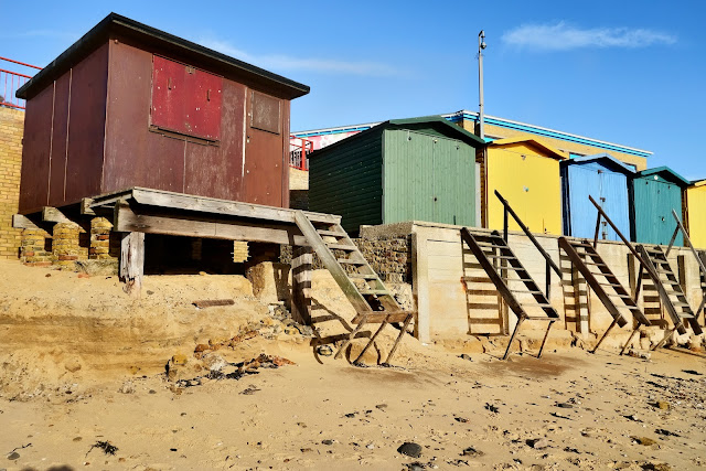
Coastal erosion at Walton on the Naze

Image
One of the areas where coastal erosion is remarkable clear is at Walton-on-the Naze, one of our favourite spots. The cliffs here are a geologists` dream, as so much can be learnt from the multiple layers that are exposed, and which change over the seasons, year on year. Some information found on the web: The town of Walton-on-the-Naze lies on the north-east coast of Essex, about 10 kilometres south of the  port of Harwich. The town itself has a population of around 6,000 people although this increases with  visitors during the summer. The word Naze comes from the old English word ‘naes’ which means nose. The Naze itself is a promontory found to the north of the town. Part of it is made up of a hill about 23  metres high which ends in cliffs which rise directly from the beach. Further north the land gets gradually lower 300 metres until it drops to the level of the beach. The Naze separates the North Sea on its eastern edge from the Walton Channel on its west. In the north, the land end

Dover Castle and the White Cliffs

Image
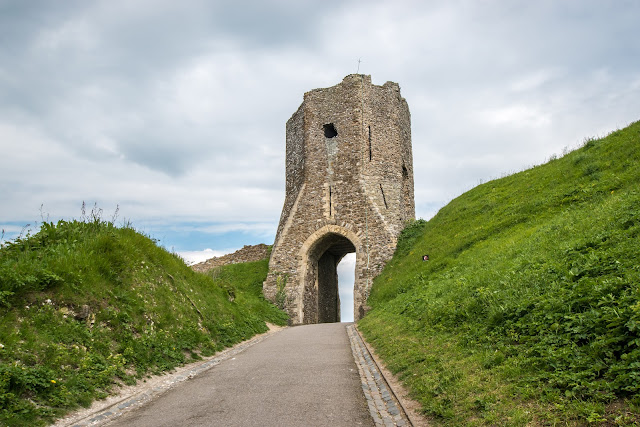
A short trip to Dover was today's plan. The castle and the WW2 underground tunnels being our main focus, followed by a visit to the National Trust site to get a photo or two of the White cliffs. We parked our car, and ticket purchased, we made our way into the Castle area. It is breath taking in its scale and you can see why tourists flock here from abroad. Being near the ferry terminal might help! We spent several hours wandering around and reading and listening at the many information spots.  The Medieval Colton Gateway of Dover Castle - The entrance though which Roman, Saxon and probably their Iron Age predecessors once entered their respective fortifications. St Mary in Castro, or St Mary de Castro, is a church in the grounds of Dover Castle. It is a heavily restored Saxon structure, built next to a Roman lighthouse which became the church bell-tower. St Mary serves the local population and is the church of the Dover Garrison. There are records of

What can be seen at Walton on the Naze?

Image
Walton is a traditional seaside town on the east coast, unique in that it is surrounded on three sides by the sea. Its three miles of gently shelving sandy beaches facing south-east stretch from Frinton to the Naze. To the north, the sea sweeps round the Naze into the backwaters, known as Hamford Water, and the Walton Channel stretches right down to Walton Mere, only 300 yards from the main beach. The Naze, as well as being a natural open space, is a Site of Special Scientific Interest (SSSI) famed for its fossils found in the Red Crag cliffs. As well as these glorious natural features, Walton is known for its pier – the second-longest in the country – its yacht club and marina, and its iconic tower at The Naze from where panoramic views can be enjoyed of the Walton backwaters, Harwich and Felixstowe and the Suffolk coast.  The coast of East Anglia is always subject to erosion and the day of our visit to Walton demonstrated the effects which a stormy period on the North se