Thursday, 25 June 2015

Clouds Hill and TE Lawrence
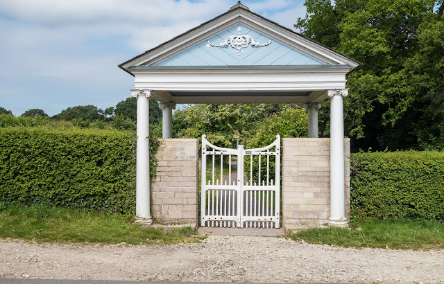
Moreton, the start point for todays walk, is a village and civil parish in Dorset, England, situated on the River Frome about 8 miles (13 km) east of Dorchester. It has a number of long distance foot paths and cycle ways passing through it. So we started our walk from here.
Moreton has become synonymous with the memory of T. E. Lawrence, also known as Lawrence of Arabia. He rented nearby Clouds Hill cottage from his cousins, the Framptons, while serving at Bovington Camp. Following his death in 1935 he was buried in Moreton churchyard where his grave attracts tourists from around the world.
Who was TE Lawrence? - Some history, (courtesy of BBC):
Lawrence was a British scholar, writer and soldier who mobilised the Arab Revolt in World War One and became famous as 'Lawrence of Arabia'.

Thomas Edward Lawrence was born on 16 August 1888 in north Wales. His father, Thomas Chapman, had left his wife to live with Lawrence's mother, a governess. Lawrence studied at Oxford University and in 1909 visited Syria and Palestine. A year later he joined an archaeological dig in Syria, where he stayed from 1911 to 1914, learning Arabic. He developed a deep sympathy for the Arabs who had lived under Turkish rule for centuries. In 1914, Lawrence was part of an expedition exploring northern Sinai, carrying out reconnaissance under cover of a scientific expedition.

When war broke out, Lawrence became an intelligence officer in Cairo. In June 1916, the Arab Revolt began against Turkey, an ally of Germany, a revolt the British had worked hard to encourage. Lawrence became liaison officer and adviser to Feisal (also Faisal), son of the revolt's leader Sharif Hussein of Mecca. Lawrence was a superb tactician and a highly influential theoretician of guerrilla warfare. His small but effective irregular forces attacked Turkish communications and supply routes, tying down thousands of Turkish troops and preventing them from fighting against regular allied forces under the command of General Edward Allenby. Lawrence's overriding aim was to help the Arabs achieve military success that would lead to post-war self-government.

In June 1917, the Arab forces won their first major victory, seizing Aqaba, a strategically important Red Sea port. Success continued as they gradually made their way north. After the fall of Damascus in October 1918, Lawrence left for London and then the Paris Peace Conferences to lobby for Arab independence. Before the conference had even begun, the British and French had agreed on the future of Turkey's Arab territories. Lawrence was disillusioned by his failure to bring the Arabs self-rule, but was by now a celebrity, helped by the publicity efforts of American journalist Lowell Thomas.
In 1921, Colonial Secretary Winston Churchill appointed Lawrence as an adviser, but in 1922 he resigned and joined the Royal Air Force in an attempt to find anonymity. During the 1920s and early 1930s, he served both in the RAF and the Tank Corps under assumed names, but press intrusion continued to dog him. A private edition of his book 'The Seven Pillars of Wisdom' was printed in 1926. A full public edition was not released until after his death.
Lawrence left the RAF in February 1935 and died on 19 May following a motorcycle accident.


St Nicholas' Church yard in Moreton - burial place of TE Lawrence


Where the great man lived. What a surprise!

Lawrence first rented the cottage in 1923 while stationed at nearby Bovington Camp with the Tank Corps. He made it habitable with the help of a friend, then bought it in 1925 and used it as a holiday home. He described it as an earthly paradise and wrote "Nothing in Clouds Hill is to be a care upon the world. While I have it there shall be nothing exquisite or unique in it. Nothing to anchor me." The cottage had no electric lights and three living rooms, described as an eating room, book room and music room. For heat insulation Lawrence had the eating room lined with asbestos that was covered in aluminium foil, and he kept his food under glass domes. In the book room he installed a large leather divan, and in the music room above it he had his gramophone "with a huge amplifier horn", a leather sofa and chair.
In 1935 Lawrence left the Royal Air Force and lived at Clouds Hill. A few weeks later, at the age of 46, he suffered severe head injuries in a motorcycle accident close to the cottage, and died in the Bovington Camp hospital on 19 May 1935. The following year, his heir, his brother A. W. Lawrence gave Clouds Hill to the National Trust. It is now a museum, dedicated to Lawrence. It is open to visitors from March to the beginning of October, Seven days a week from 11am to 5pm
The cottage remains largely as Lawrence left it at his death. It features an exhibition detailing Lawrence's life, and most of his original furniture and possessions. The cottage reflects his complex personality and links to the Middle East.


The outhouse where Lawrence kept his motorcycles.


Strange!


A tank trundling down the road from  Camp - base of the Tank Corps. Quite a sight I can assure you! Not your usual encounter on the roads at home!
After finishing our walk, which also included some Geocaches, we headed for St Oswald's Bay, near to Lulworth ...


......and watched the mist swirl in off the sea. It was here that Rosey took a picture of a butterfly that she had not seen before, the Lulworth Skipper.


Then headed home via West Lulworth, where I took this image of some lovely thatched cottages.


Home    Forward   Back

Wednesday, 24 June 2015

The Giant Man and Sherborne

At the start of our explore of Cerne Abbas, we walked along the top of the ridge known as Giant Hill or Trendle Hill. The scenery was beautiful and the flowers added to a very pleasant morning walk


The Cerne Abbas Giant is located just outside the small village of Cerne Abbas in Dorset, about 48 kilometres (30 mi) west of Bournemouth and 26 kilometres (16 mi) north of Weymouth. The figure depicts a huge naked man, about 55 metres (180 ft) high and 51 metres (167 ft) wide. It is carved into the white chalk rock on the steep west-facing side of a hill known as Giant Hill or Trendle Hill. 
The carving is formed by outlines cut into the turf about 0.6 metres (2 ft 0 in) deep, and filled with crushed chalk. In his right hand the giant holds a knobbled club 37 metres (121 ft) in length, and adding 11 metres (36 ft) to the total height of the figure. A line across the waist is considered to be a belt. 
A 1996 study found that some features have changed over time, concluding that the figure originally held a cloak in its left arm and stood over a disembodied head. The former presence of a cloak was corroborated in 2008 when a team of archaeologists using special equipment determined that part of the carving had been allowed to be obliterated. The cloak might have been a depiction of an animal skin, giving credence to the theory that the giant was a depiction of a hunter, or alternatively, Hercules with the skin of the Nemean lion over his arm. Additionally, reviewing historical depictions of the giant, it has been suggested that the Giant's current large erection is, in fact, the result of merging a circle representing his navel with a smaller penis during a re-cut. In 1993, the National Trust gave the Giant a "nose job" after years of erosion had worn it away. 
The Giant sports an erection, including its testicles, some 11 metres (36 feet) long, and nearly the length of its head. One commentator noted that postcards of the Giant were the only indecent photographs that could be sent through the English Post Office. 
Although the best view of the Giant is from the air, most tourist guides recommend a ground view from the "Giant's View" lay-by and car park off the A352 Not as good as the aerial shots but a record nonetheless.


The lone tree

Sherborne is a market town and civil parish in north west Dorset, in South West England. It is sited on the River Yeo, on the edge of the Blackmore Vale, and was made the capital of Wessex, one of the seven Saxon kingdoms of England. King Alfred's elder brothers King Ethelbert and King Ethelbald are buried in the abbey. 


The former church of Sherborne Abbey is one of the county's finest medieval buildings. The first church here was established in the 8th century as part of a Saxon abbey. Of that Saxon building little remains beyond a doorway. 
Tradition tells us that the abbey was established by St Aldhelm, who came to Sherborne in AD 705 at the invitation of his relative, King Ine. The king had divided the huge see of Winchester in two parts, and wanted Aldhelm to serve as the bishop of a new see that encompassed Dorset, Wiltshire, Somerset, Devon, and Cornwall. 
It seems very likely that Aldhelm established his new abbey on an existing place of worship, which would make the foundation of Sherborne Abbey very ancient indeed. Aldhelm came to Dorset to assert the authority of the Roman Catholic style of worship over Celtic Christianity, and it is said that 'by his preaching he completed the conquest of Wessex'. The abbey church served as the cathedral seat of 27 Saxon bishops until the bishopric was moved from Sherborne to Salisbury in 1075. Even after this the Bishops of Salisbury retained the manor of Sherborne and the 12th century castle here. 
After the see was moved to Salisbury the abbey church became the church of a Benedictine monastery. The monastery lasted until it was dissolved by Henry VIII at the Reformation, and then the monastic church became the parish church of Sherborne. 
There is nothing left of St Aldhelm's original abbey. There is surviving Saxon stonework at the west end of the present church, but this dates to a later Saxon rebuilding of Aldhelm's monastic church. The original Saxon church probably stood to the west of the present nave. During the bishopric of Bishop Alfwold (1045-1058) a new, larger church was begun to replace the earlier single-celled building. The new Saxon church consisted of a nave and choir with transepts. This forms the basis of the building we see today. The remainder of this magnificent medieval building was the work of Abbot Ramsam (1475-1504), who built the choir and rebuilt the nave and north transept. 


The Conduit is a 16th century hexagonal washing area originally used by the Monks of Sherborne Abbey. With the dissolution of the monastery in 1539 the building was moved to its current location on Cheap Street. I just managed to chop the side in this image, in my attempt to capture the other buildings! 


Midsummer, also known as St John's Day, is the period of time centered upon the summer solstice, and more specifically the northern European celebrations that accompany the actual solstice or take place on a day between June 19 and June 25 and the preceding evening. The exact dates vary between different cultures. The Christian Church designated June 24 as the feast day of the early Christian martyr St John the Baptist, and the observance of St John's Day begins the evening before, known as St John's Eve.The garland was in place when we visited St John's House (see below) 


There are many examples of the use of Midsummer garlands in the Middle Ages, as exemplified in this article.


The almshouses of saints John the Baptist and John the Evangelist, founded in 1438 and expanded in the Victorian era in indistinguishable medieval style architecture. 


Looking around these wonderful old towns you can be sure to find some lovely examples of sundial, this one being in the town of Sherborne. 


I just love window and door combinations and this one took my eye in Sherborne 


Home    Forward   Back

Tuesday, 23 June 2015

Around Winterborne Stickland

Today was a more restful day, and I spent the morning Geocaching around the village where we stayed. Only managed to find three I am afraid, but enjoyed myself anyway! While doing this, I took a few images of the local church.


One of the more historic churches in Dorset, St. Mary’s parish church in Winterborne Stickland occupies a central position in the village and dates from the 13th century. Built using a fabric of alternating flint and stone courses, the roof is partly tiled and partly slatted. The church is on the usual east-west axis and features a Perpendicular 15th century tower on the west side constructed of banded flint and ashlar. St. Mary’s underwent a restoration in 1892.


One of the lovely thatched properties in the village


A short walk in the afternoon and a couple of images above. The Rose Chafer and a pretty lily on a pond . Apart from that, not much today.
The Rose Chafer is a large, broad beetle that is found in grassland, scrub and woodland edges. The adults feed on flowers, particularly dog roses, during the summer and autumn, and can be spotted in warm, sunny weather. The larvae feed on decaying leaves, plants and roots, living in the soil for several years as they develop. When they pupate, they hibernate in the soil or in rotting wood over winter, ready to emerge as adults the following spring.


Home    Forward   Back

Monday, 22 June 2015

Lulworth Estate and Durdle Door

The Lulworth Estate extends over 12,000 acres (20 square miles) of the south Dorset countryside, including 5 miles of the Jurassic Coast and internationally renowned landmarks such as Lulworth Cove and Durdle Door. Lulworth estate pedigree can go back as far as Doomsday times in the 11th century and beyond, and, since 1641, it has been owned and managed by the Weld family.
In 1641 Humphrey Weld, grandson of a rich London Merchant and direct ancestor of the current owner, purchased the Lulworth Estates from Thomas Howard who had built the Castle here between 1608 and 1610 to complement his manor house at Bindon Abbey in the nearby village of Wool.
Humphrey did not have the Castle for long before the Civil War erupted in England, during which the manor house at Wool was destroyed and the Estate sequestrated by the Parliamentarians. After the Civil War Humphrey Weld needed to refurbish the Castle’s interior as it was now the main family home and needed alterations to make it permanently liveable.
Over the years, the Castle has had various uses, occupants and a diverse and colourful history. There have been a number of significant events at the Castle, some like the fire of 1929 were devastating, others less so but equally as important in the Castle’s history.
From a perilous state of decay following the fire the Castle was saved from eventual ruin. The exterior is now fully restored and the interior consolidated. Exposed to the elements for 70 years after the fire, the Castle decayed rapidly, stonework eroded and unburnt timbers rotted until the whole structure was in danger of collapse.
Discussions between the Weld Estate and English Heritage led to the start of a programme of consolidation. The first priority was safety; dangerous and crumbling masonry was supported, scaffolding erected and the site was cleared of vegetation and loose debris.
Stripped of plaster and panelling by the fire, the naked walls revealed their history. Previously hidden details like blocked doorways and scars of demolished walls, together with historic records, were used to interpret the building’s development over the centuries. The project was completed in 1998 when the Castle opened its doors for the first time since the fire to allow the public to explore this unique building and discover its past for themselves.


Built in the early 17th Century as a hunting lodge, Lulworth Castle became the family seat at the heart of this large estate, hosting royalty and aristocracy before it was ravaged by fire.


The Weld Arms in Lulworth was a great spot to have our lunch


Lulworth Cove


Lulworth Crumple & Stair Hole


No visit to this area would be complete without a visit to Durdle Door - magnificent!


A view the `other side` of Durdle Door.


Sunday, 21 June 2015

Studland, Poole in Dorset

Today was a visit to Studland for a circular walk along Ballard Down and back through the heathland. This is one of my favourite walks and a must if in the area.


Ballard Down offers some of the best downland habitat in southern England and is home to many butterfly species, including Adonis blue and chalkhill blue. This one I believe is a Chalkhill Blue.


The stunning views along Studland Bay


Canoeists having fun along Studland Bay


Standing tall at the southern end of Studland Bay is one of the most famous landmarks on the South Coast – Old Harry. How Old Harry got his name is hotly debated. Some say it is linked to the Devil who, legend had it, once took a nap on the summit.
Others claim he is named after the notorious Poole pirate Harry Paye who terrorised the English Channel in the 14th century. It is said Harry’s ship used to lurk behind the rocks ready to pounce on passing merchantmen.
Whatever the truth, the bridleway from Studland village to Old Harry and Ballard Down beyond is today of the best loved walks in Dorset, and is also popular with mountain bikers and horse riders.
Until 1896 there was another stack beside him known as Old Harry’s Wife, but erosion caused her to tumble into the sea, leaving just a stump.


Shall I - shan't I?


Daucus carota, whose common names include wild carrot, bird's nest, bishop's lace, and Queen Anne's lace


Ballard Down - the walk is spectacular and it`s easy to see why it is one of the favourite walks on the Dorset coast.


Orchids on Ballard Down


Stone seat seen near the junction of two paths, at the top of Studland Hill. At one end is an inscription that appears to read "D.J. 1852"


The obelisk at Ballard Down commemorates the provision of a new supply of drinking water for Swanage in 1883. It was taken down in 1941 as it was a landmark that might have aided enemy aircraft during World War II, but was re-erected in 1952.


Some of the best views of the heath sweeping down to the shores of Poole Harbour are from the dramatic Agglestone – a 400 tonne rock sitting alone on a hill as if a giant had dropped it there. 
So out of place does it seem that legend suggests it was placed there by supernatural forces. It is said the Devil was sitting on The Needles when he saw Corfe Castle being built. He was so offended by the beautiful white tower of the Norman keep that he threw his cap at it: the missile fell short, however, and became the Agglestone. 
Legend aside, the 17-foot rock is thought to be part of a band of ironstone which crosses the heath, also including the nearby and much smaller Puckstone. 
When you arrive here you know you are not far from the end of your walk.


A closer view of Agglestone


Home    Forward   Back