Wednesday, 20 May 2015

Winnie the Pooh and Glamping

What about a try at Glamping? Well, it sounded fun so why not give it a try? So off to the heart of Sussex, and here are a few images of the first couple of days.


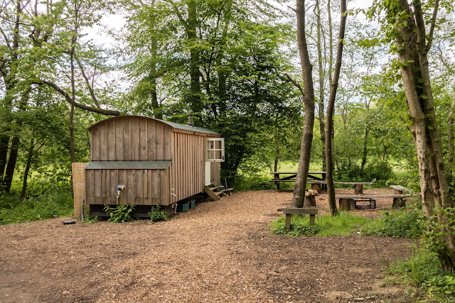
Our Bluebell Shepherds Hut on the Wapsbourne Manor Farm campsite (Wowo for short) in Sheffield Park, Uckfield - the heart of Sussex. Near enough to Winnie the Pooh country, which was the main reason for visiting this part of the country, and also to enjoy other parts of the Ashdown forest.


Some views of the interior of our Shepherds Hus, cramped, but on a lovely site. The site was quite empty while we were there, but could cater for a large number of people with facilities for workshops and concerts etc. 


There were all sorts of vans to hire, this being one of the many dotted around the site. 


Site of A A Milne memorial 

We followed one particular walk in the Ashdown Forest to see some of the places associated with Winnie the Pooh, but were a bit disappointed as they were very overgrown. However, we did find the memorial plaque for A.A. Milne and E.H. Shepard, the author and illustrator (respectively) of the world-famous Winnie-the-pooh books. The memorial is placed on Gills Lap in the Forest. The Ashdown Forest inspired much of the Winnie-the-pooh world. A lot of the geography and place names in the books are taken from the Ashdown Forest. For example, Gills Lap in the book is is called "Galleons Lap, the Enchanted Place at the very top of the forest". 
The plaque reads: 

"and by they came to an enchanted place on the very top of the Forest called Galleons Lap" 
HERE AT GILLS LAP ARE COMMEMORATED A.A.MILNE 1882-1956 
AND E.H.SHEPARD 1879-1976 
WHO COLLABORATED IN THE CREATION OF "WINNIE-THE-POOH" 
AND SO CAPTURED THE MAGIC OF ASHDOWN FOREST AND GAVE IT TO THE WORLD 


Looking up through the trees 


The Folly Bridge in Chelwood Vachery 

Chelwood Vachery is an early-20th-century garden, laid out in 1906 by Leonard Rome Guthrie as the setting for a mansion by architect William It has a series of terraces descending to a water garden and surrounding arboretum with rhododendron walks. Further water features comprising a spring-fed gorge with waterfalls and a chain of lakes were constructed in the woodland from 1925 by the landscaper Gavin Jones. This was an area we chose for one of our walks. 


Another view of the Folly Bridge 


Swirls in the water 


Part of the spring-fed gorge with waterfalls. Not at its best when we were there, but nevertheless, a pleasant walk.


Nutley Post mill - A wind powered corn mill 

A small post mill located on the edge of Ashdown Forest, Nutley Mill was restored by a band of skilled volunteers between 1968 and 1972 and has since been maintained in full working order by the Uckfield & District Preservation Society. The mill is one of five remaining open-trestle post mills in the country. The centre post of the mill has been dated by dendrochronology (tree-ring dating). It was shown to have begun life as an acorn in 1410 and was eventually felled in the mid-16th century. 
The mill is clad with brown weatherboarding and a simple tailpole and talthur are employed to turn the mill body into wind. One pair of sails (known in Sussex as 'sweeps') are of the spring-shuttered type and the other pair are common sails, manually spread with canvas. In operation, each sail must be stopped at its lowest point to allow the shutter tension to be adjusted or the canvas to be spread across the sail frame. The sails are mounted on stocks at the head of a cast-iron windshaft which carries both head and tail wheels. Both wheels are of the wooden clasp-arm type. The millstones at the rear (tail) of the mill are of Derbyshire Peak and the headstones are of French Burr. A flour dressing machine, also on the millstone floor, is driven via a layshaft by the tail wheel. 


There is a storm brewing! And it sure did rain for a while. 


Trees and flowers on Broadway Amble - the official name for our walk on another day. 

Home    Forward   Back

Sunday, 17 May 2015

Family Fun at Rendlesham Forest

Rendlesham Forest is a great place for walks if you want to get closer to nature. It is a place we visit most years and today the family descended onto the forest to see what fun could be had.


One of the first things we tried was rounders, with pine cones being the ball - great fun!


Emily tries her hand at another game on site.


Even the adults are allowed to be a bit silly


Emily in playful mood.


Emily was very good on the zip wire.


Izobelle needed a help from mum but loved it anyway.


Finally we all sat down to a well deserved picnic. A great day which everybody appeared to enjoy.


Home    Forward   Back

Sunday, 10 May 2015

More Fun with the Birthday girl

Izobelle had her 3rd birthday on 10th May and a meeting with her cousins was a first choice. The party day started at Hollow Trees farm, which is a great place with it`s farm shop, cafe and trails for the youngsters. Then we were to move on to Hayley`s home to have cake etc.


So, starting at the farm, first picture is of the birthday girl herself.


Emily in reflective mood on the tyre swing.


And then driving the `static` tractor. A great favourite.


Throwing the wellie


Back at home with the cake. `This cake is rather yummy Izobelle`


Looks like some face painting has been taking place.


Home    Forward   Back

Thursday, 23 April 2015

Stackpole Estate - my first visit

A `must visit` place in Pembrokeshire is the NT Stackpole estate which has some of the most stunning coastal views to be found anywhere. It’s difficult to imagine the many buildings that may have graced the Stackpole Court site over the centuries. Occupied since Norman times, the Stackpole Estate has seen its fair share of boom and bust over the centuries. The Campbell's built the early Georgian mansion of Stackpole Court in the Palladian style in the 1730s on the site of the earlier fortified house.
Two world wars heralded a century of decline at Stackpole. Half of the estate, around 6,000 acres, was requisitioned by the Ministry of Defence to form Castlemartin Range in 1938.

Sir John Campbell II inherited the estate in 1777 and began landscaping work on a grand scale. What was once a valley was later flooded to create the Bosherston Lakes, as part of a designed landscape, and thousands of trees were planted.
Thirteen years later, what was left of this historic estate was broken up and the farms were sold. Thankfully the coast, woods and lakes passed to the National Trust and were saved for the nation.


Stackpole Quay

Today we intended to walk the remains of a once grand Stackpole Estate. We started near Stackpole Quay, a small harbour nestled in amongst the cliffs which is a favourite venue for kayakers who can be seen bobbing up and down exploring the caves and cliffs nearby.
Then onto Stackpole Head itself, a stunning piece of coastline with the amazing Stackpole towering cliffs with bird life in abundance nesting on it`s ledges.
Further along we came to Barafundle bay – a small bay backed by dunes and pine trees.
Then we reached Broadhaven South beach and before turning toward the lakes of the Stackpole estate, over the Eight Arch bridge picking up a cache and eventually arriving back at our car park.
Sandwich, cake and coffee at The Boathouse was a great finish to a stunning walk.


The rugged coast near Stackpole Head

Stackpole Head where the sea has sculpted stacks, caves, arches, inlets and headlands, and where razorbill, guillemot, chough, peregrine and raven live. Unfortunately the tide was high at the time we did our walk but from the top it was still dramatic to say the least.


Rosey photographing Gannets nesting on the ledges of Stackpole Head and Stackpole Headland itself, one of the most spectacular parts of this walk


Barafundle Bay

Barafundle Bay – a small bay backed by dunes and pine trees, accessible only by a half mile walk from the nearest car park. Swathes of golden sand and crystal clear waters, Barafundle has been voted many, many times as one of the best beaches in Britain and the world; it’s often likened to a Caribbean beach! This pristine beach is isolated which means no facilities; so everything you take has to come back up over the cliffs.


A large jellyfish stranded on the sands at Barafundle bay


Church Rock - I guess it looks a bit like one.


The Eight Arch Bridge on the Stackpole Estate is a grade II listed construction.. It is owned and maintained by the National Trust.
The bridge was built in 1797[2] to connect Stackpole Court and Home Farm to Stackpole Quay and the New Deer Park. At some point face-to-face iron ties were added to hold the bridge together.
On 2 August 1996 it was listed by Heritage in Wales (now Cadw) as grade II for its eye catching nature as a major feature of Stackpole Park, and as part of the Stackpole group of buildings.
The bridge is built over a weir between two ponds (part of the Bosherston Lily Ponds). There are eight segmental arches in limestone, one with slightly projecting keystones. The arch rings are in ashlars; the rest of the arches in common stonework. There are a low rebuilt parapet walls, with slight wing walls at each end, on either side of the 3.3-metre (11 ft) roadway.


There is a series of interconnecting lakes, created at the turn of the 19th century by Baron Cawdor, once the owner of the Stackpole Estate. He dammed a small tidal creek which then flooded the three tributary valleys. Subsequent drifting of sand has created a large marram grass-covered dune system behind the beach. The lakes are abundant in wildlife, with herons prowling the shallows, swans, ducks, moorhens and coots all easily visible on the surface, and shyer creatures such as kingfishers often spotted. The Lily Ponds, which are made up of the two westerly fingers, are managed as a National Nature Reserve, and the lilies themselves are at their best in June, while the woodland is a magnificent spectacle in spring and autumn.
Well, all good things come to an end, so promptly the following morning we pointed our car east and headed for home.


Home    Forward   Back

Wednesday, 22 April 2015

A trip to Skomer

Today a trip to Skomer! We boarded the 11am ferry with 15 or so other passengers for our short 10 min crossing, the sea being really calm. On the approach to Skoma we saw Puffin in large numbers flying around, or just swimming in groups on water.
After a short talk by the Wardens, we were off to see what we could see toward the center of the island, photographing the trigpoint on the way and walked toward The Wick.
This was the area that we saw the most puffins in their burrows – brilliant. While strolling along this area we also saw choughs flying around.
We stopped and had our picnic lunch and continued before deciding to head back through the centre toward the old 19th century farm buildings and the landing stage in hope more puffin pictures Saw some on the water only, but great walk anyway.
The boat very crowded on way back but it was only a short journey. All in all, a great trip and well worth doing.


Trig point on Skomer marking its height above sea level at this point of 79.357 m


What would a trip to Skomer be without a picture of a Puffin?

These delightful birds with their brightly coloured bills are part of the largest colony of puffins in Southern Britain. Each year around 6,000 of them return to spend the spring and summer on Skomer.
Puffins arrive on Skomer in late March, but don’t immediately settle down on the island. Initially they collect in rafts at sea, as if to build up their confidence to storm the island. But soon they return to the cliff tops to re-occupy burrows where they will lay a single egg which will hatch in June. After, the birds can be seen flying into the island, with beaks lined with sand eels. By late July the birds depart the island and return to a life at sea. It is then that the brightly coloured bills, for which puffins are so recognisable, fade, to come to life again next spring.
Many people are surprised when they first see a puffin by how small they are, just 30cm from beak to tail. They also marvel at how relaxed they seem around visitors to the island, crossing the paths to reach their burrows, while navigating their way through feet and legs.
The day we arrived, many had gone fishing, but we managed to see several around their burrows.


Our boat returning to the mainland.


Harold`s Stone

The Harold Stone is an erect monolith, 1.7m high by 0.8m by 0.5m. It tapers from a broad base to a point, with its edges aligned nearly north-south; its wide face is orientated to face the sea to the east and the island to the west. It is one of several stones in south-west Wales bearing the same name. Gerald of Wales asserted that the stones were erected by Earl Harold to commemorate his victories over the Welsh in 1063. Although the Harold Stone on Skomer is currently undated, excavations at other similar stones in Pembrokeshire have always yielded a prehistoric, or Bronze Age, date. It is therefore safe to assume that this stone is also a Bronze Age monument, marking a burial (in a cremation urn) or an area of now concealed ritual and funerary activity.
It has be said that not everyone thinks it is that old – but it sounds good!


Lime Kiln on Skomer


Awaiting the boat from the mainland


Once back on the mainland, we moved a short distance to a car park closer to Marloes Sands where a walk revealed another Earthcache.
Marloes Sands is another stunning beach and the Earth Cache well worth seeing. It`s a 1.5 kilometres (0.93 mi) long remote sandy beach where the Earth Cache was situated. Not a soul in sight!


The Three Chimneys

Geologists journey here to this remote spot from all over the world to take a look at an exposed stretch of Silurian rocks known as The Three Chimneys – near-vertical beds of alternating sandstones and siltstones demonstrating different states of weathering. Geological Surveyors have carved in the rock a small arrow, not difficult to find, to mark where the Silurian rock ends and the Old Red Sandstone begins. This picture was proof of my visit to the Earth Cache.


Wild flowers galore this time of year.

The end of another lovely day - we definitely will come back to Skomer!


Home    Forward   Back

Tuesday, 21 April 2015

A Geocaching day in Pembrokeshire

Tuesday we decided to try and pick up a few local Geocaches and our first stop was for one at Nolton Haven, a pretty beach as usual. If you have never tried Geocaching follow this link for an explanation. As a worldwide treasure hunt, it is suitable for most ages, and is great fun - and addictive!


In the 19th century this was a busy port, as coal was exported from Nolton and nearby Newgale. It was a good easy cache to find.


Newgale – great surfing bay with beach berms (Piles of shingle / stones) 

Maidenhall was our next stop, where a great view from the car park viewpoint and another cache awaited. Well hidden in the wall. 
Then a short drive to Newgale with it`s great surfing beach and berms. Here, one earth Cache and two regular ones completed our tally before heading back to Broad Haven for a steak pie lunch – lovely! So, a berm, a dictionary definition is: A nearly horizontal plateau on the beach face or backshore, formed by the deposition of beach material by wave action, or by means of a mechanical plant as part of a beach recharge scheme. 
So, there you have it, a bank of stones piled high by the action of the waves, and quite a sight it was. To log the Earthcache, I had to send a picture of myself on top of a berm holding a large flat stone from the top of the berm. Plus, answering the question as to `why the largest stones were on the tops of the berms`. 


Musselwick beach 

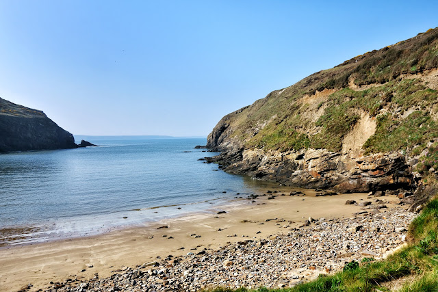
After lunch, we headed down to Martin's Haven on the The Dale Peninsula to check on our intended trip tomorrow across to Skomer. One cache at Musselwick beach and another at Ye Olde Bridge on the way home, and that was it for the day. 


On the wall by Ye Old Bridge

So, a few Geocaches found and logged and another few of the amazing scenery viewed. Just reinforcing why this part of the UK is one of my favourites.

Home    Forward   Back