Friday, 27 June 2014

Our last two days on Mull

So dawned our last day of Mull, and a great holiday it has been. Peaceful, interesting and lots to see.


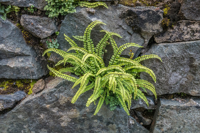
This fern just appealed to me as it sprouted from the stone wall - Polypodium vulgare, the common polypody. Seen at a stop on our way to today's adventure.


Another abandoned cottage as we drove toward Loch na Keal, intending to explore another area we had not seen much of to date.


Northern Eggar caterpillar or asiocampa quercus, as its Latin name.


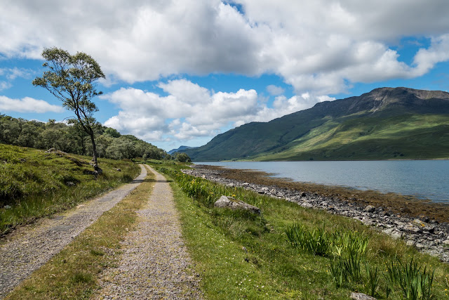
Loch na Keal - We drove along the southern edge of the loch toward Loch Ba. This was another unspoilt and beautiful drive. We watched sea eagles over the loch and just looked at the peaceful scenery, with all the worlds problems a million miles away.


We came across this pile of stones, obviously left by some earlier passer by.


Loch Ba


More views of Loch Ba


Our interest in this Mausoleum is the fact that, while traveling in Australia, Macquarie was a town that we passed by and it resonated when we came across this Mausoleum so unexpectedly in Mull!

So for a snippet of history as to what the connection was:
Lachlan MacQuarie was born on the Isle of Ulva, just off the northwest coast of Mull, in 1761. His father was a cousin of the last chief of Clan MacQuarrie. He joined the military in 1775, at the age of just 14, and rose to become a Major General, but retired to travel the world after 30 years of service. When his first wife died shortly after their marriage, MacQuarie was despondent and returned home to Mull. There he met and married his second wife, Elizabeth Campbell, in 1807. In 1809 he was offered the post of Governor of New South Wales and moved to Australia.
During his tenure in office (1810-1821) MacQuarie travelled widely in Australia and helped improve the political stability of the newly developing region. He resigned his post in 1821 due to poor health, and moved back to Mull, where he died in 1824. 

So influential was MacQuarie in the establishment of a new and - for the time - relatively independent nation, that he became known as 'The Father of Australia' after his death in 1824.
After his death the mausoleum was built in the grounds of the Gruline estate, which he owned. The mausoleum is a very simple structure built of sandstone, a rectangle with a slate roof and gables at each end. There are three small mock buttresses on each long wall. Both gable ends have an inset niche, occupied entirely by a large carved monument in marble. Inside are buried Lachlan and Elizabeth MacQuarrie, and their 2 children; son Lachlan and daughter Jane, who died in infancy.


And so, as we wait to leave Mull, we watch as our ferry approaches and contemplate a fabulous holiday. I would like to return, if the weather were to be a kind as it was this time!


Our parting view of Castle Duart on our way back to the mainland. Unlike the day we arrived, this was a clear mist free one.


Monday, 23 June 2014

Fionnphort, Fiddon & Salen

The A849 crosses Mull West / East (or East / West if you fancy!) and we travelled westerly today until we reached Fionnphort which is the Ferry Port for Iona.


The whole route is through stunning landscape and beside a loch - Loch Scridain to be precise. The weather looked threatening as we progressed, but thankfully the rain held off.


Fionnphort was nothing remarkable, but it was of interest to see Iona just a short ferry trip away. The beach looked as if, on a sunny day, it might have been beautiful to picnic or sunbathe on. From here we drove a short distance to Fiddon. Another stunning beach with pink granite outcrops and a large white sandy bay.


Some of the rocks on Fiddon beach.


And a row of camper vans next to Fiddon beach. 

Just off the Fiddon coast is the island of Erraid. It is a tidal island one mile square in area which lies off the south west of Mull. It is connected by a beach at low tide to the Isle of Mull and it is renowned for being one of the driest and sunniest places on the west coast of Scotland. The island has a disused signal station for the lighthouses on Dubh Artach and Skerryvore and a row of cottages built for the lighthouse keepers which is today used by the community of the Findhorn Foundation.
For an hour or two either side of low water, it is linked to the Ross by a broad expanse of sand. 
The author Robert Lewis Stevenson was raised on Erraid, being a member of the great Stevenson Family, renowned for lighthouse engineering. 
In Stevenson’s “Kidnapped”, the hero, David Balfour is shipwrecked and comes ashore on the south coast of Erraid (Balfour Bay) at a sandy bay. In “Treasure Island”, Jack Hawkins chart bears a resemblance to Erraid. 
Erraid is now owned by a family from overseas, but is used by the Findhorn Community for most of the year. This group runs course and “retreats” and grows a large proportion of its soft fruits and vegetables. These gardens have now been expertly managed, on an “organic” basis for years and are of a very high standard indeed. 
Unfortunately for us, we arrived at the wrong tide time!


Loved this pink roadside sign

The following day we travelled north to Salen and had a wander along a Forestry Commission walk. The main attraction of this walk is the old graveyard of Cill an Ailein, housing some graves dating back to the Middle Ages. The earliest legible inscriptions date from the eighteenth century and one small stone commemorates a shoe-maker. On the rear of his gravestone is a hammer and a high-heeled shoe. 


One of the old stones with an interesting moss growth on it. 


It is amazing the number of odd gloves you can see around. This one was on a fence near the graveyard. 


Back at base, this peacock was unperturbed by our presence 


A lovely Harebell nearby on the roadside. 


Our neighbouring village of Iverlussa had a Mussel farm. No action this evening.


Later that evening this Grass Wave (Perconia strigillaria) was spotted on the road.


Home

Saturday, 21 June 2014

Back to Tobermory and onto Duart Castle

Another drive along the Sound of Mull to Tobermory today, but a slower pace with time to explore.


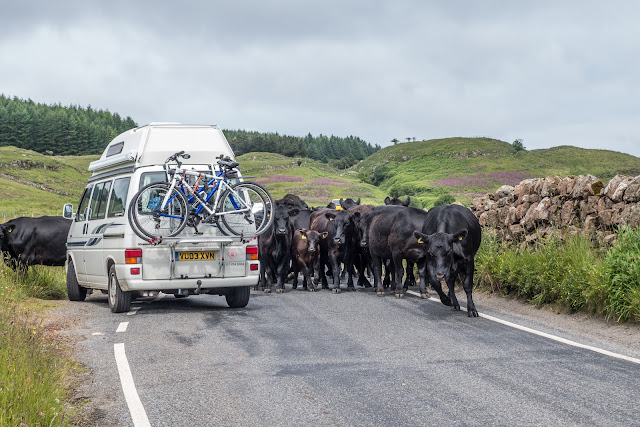
The locals decided that this would be a leisurely drive! That one in the front is coming straight for us Rosey!


This time we have a better day and the colours of the house stand out better. Lunch and a good stroll around was the order of the day.


These old vessels on the Sound of Mull looked great against the dark sky.


The village next to where were staying was called Inverlussa. So next morning we thought to take a stroll down the road and explore as we had a trip to Duart Castle planned for the afternoon.


Keeping an eye on the hedgerow as we walked, we spotted these Common Spotted Orchid, Dactylorhiza fuchsia


Then we found a grasshopper - not sure of the variety.


... and then my favourite of the morning, a Fritillary butterfly


Quickly followed by a Cinnabar moth.


Then we came across a monument to Dugald MacPhail (1818-1887) He was a Gaelic songwriter, poet and author. Born at Strathcoil on Mull in the Inner Hebrides, MacPhail worked as a joiner and architect. He moved to Glasgow with his young wife, and then to Newcastle (England) where he wrote the song An t-Eilean Muileach (The Isle of Mull), for which he is best remembered. This is now known as 'Mull's National Anthem'. He was appointed architect and clerk of works to the Duke of Westminster, which brought a move to Shaftesbury, where several of his family were born. He then moved to Edinburgh, being attracted because of the educational advantages that city brought to his family. 


In the afternoon we drove a short way to see some Highland dancers perform at Duart Castle. This was a matter of a few minutes drive from our holiday cottage.
Duart Castle proudly guards the sea cliffs of the Isle of Mull, while enjoying one of the most spectacular and unique positions on the West Coast of Scotland. Brought back from ruin in 1911, the Castle treasures 800 years of history of one of Scotland’s oldest Clans, The Macleans, and is one of the last surviving privately owned Clan Castles in Scotland.


It was very enjoyable to see real Scottish dancers, and in the great surroundings.


So, at the end of the day, what sort of sky do we have from the kitchen window?


Home

Friday, 20 June 2014

Loch Spelve and otters

Located in the south-eastern ‘corner’ of Mull, Loch Spelve is a large tidal body of water bounded by an unclassified single track road which branches off at its western end with one track running back along the southern shores of the loch to Croggan and the main track running west to Loch Buie. Being just south of where we were staying, it looked a great place to explore.


Definitely an `unclassified single track road`! 


We had read of the otters being seen here. On arriving to park, we were cruising along the Loch side when we spotted a woman, loaded with camera gear coming toward us. On speaking to her, it transpired that she and her husband (both keen photographers), were in the area photographing otters. Soon afterwards she caught our attention and we followed her along the loch as an otter went about his business on the loch side. Magic! 


Another view of the lock and an interesting tree by the side 


Curlew on Loch Spelve shore


Oystercatcher by the loch


Was this an old highlanders house destroyed in the Highland clearances? 

To quote an article in the SCOTSMAN: 
THE HIGHLAND Clearances are an infamous chapter in Scottish history, the cruel story of how the Highland people were dispossessed of their homes by their landlords. So emotive is the subject that many writers denounce the clearances as the first act of modern ethnic cleansing. Yet, while economic forces did change the face of the Highlands forever, the clearances were not a single act of genocidal intent. The clearances largely took place between the 1770s and 1850s, although eviction struggles continued until the end of the 19th century, such as the Battle of the Braes in 1882. The end of the Highland way of life really began with the Jacobite defeat at Culloden in 1746, when the British government swiftly acted to break the resistance of the proudly independent Gaelic society. Highlanders could no longer meet in public or bear arms. The wearing of tartan, teaching Gaelic and even playing the bagpipes were outlawed by the 1747 Act of Proscription. The act was repealed in 1782, but by then a more grave set of threats to the old clan system had emerged: economic collapse and agricultural revolution. The Highland economy was based largely on subsistence farming and the export of cattle, as well as kelp from the coast used to make glass and soap. At the time, many landlords complained not that there were too many Highlanders but that too many were leaving, forcing the government to pass the 1803 Ships’ Passengers Act that tightened emigration laws. This situation changed radically as the cattle and kelp industries collapsed following peace with France in 1815. At the same time, the agricultural revolution began changing the shape of farming throughout Europe from small- to large-scale production. The early Highland Clearances occurred alongside the second round of enclosures in England, where small holders were forced to leave common lands. Further, the agricultural economy shifted as demand grew for sheep in the newly industrialising cities. Sheep became more desirable to some landlords than their Highland tenants. The most notorious of the Highland Clearances occurred on the estates of the Countess of Sutherland between 1811 and 1821. Riots in Sutherland in 1813 failed to dissuade the Countess from her desire to replace Highlanders with sheep. Many families were burned out of their home. A local, Donald MacLeod, reported that from a hill he saw 250 homes from one district ablaze. The fires lasted six days. In 1816, the Countess’s factor, Patrick Sellar, was acquitted by a court on charges of arson and culpable homicide. 


White Heath spotted orchid 


Fritillary butterfly 


Victoria Jubilee This pyramid shaped monument is also on the right hand side of the road alongside Loch Uisg – shortly after the Red Monument – and just before the end of the Loch. It is set beside the road, but is some 3 meters above the road level on a low bluff of rock. The plaque reads; “Erected by Lochbuie and his Highlanders to commemorate Queen Victoria’s Diamond Jubilee, 22 June 1897. God Save the Queen”


Lochbuie Post office - unmanned, with its honesty box in the image above. Not sure how that would work in many places!


To round off a very pleasant day, this was the view from our kitchen window in the evening.