Sunday, 16 June 2024

Ingleton - the start of our Yorkshire holiday

Although we had visited many of the places around this area before, it was `many moons` ago - 12 years to be precise! So we were looking forward to this holiday, although the thought of the journey was a bit daunting. As it turned out, the journey was not as bad as anticipated and the A14 - M6 route was easy to follow.

Arriving in Ingleton, we soon found our cottage and made ourselves at home. The weather had threatened us, but the week overall did not turn out too bad, enabling us to see most of what we had planned.

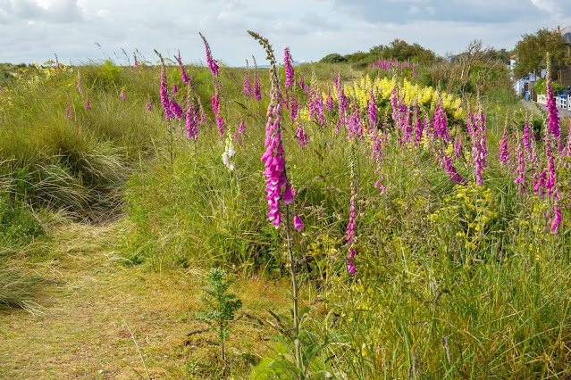
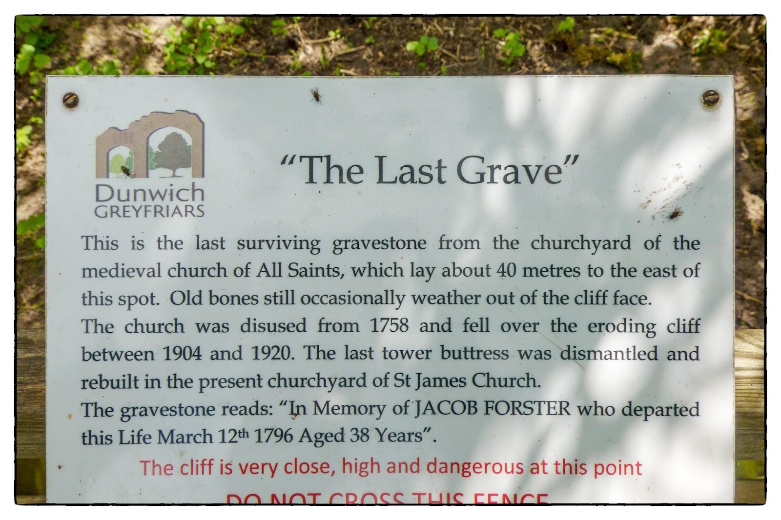
One of the things which first struck me was - rivers. Ingleton has the River Doe and the River Twiss meetinng to form the source of the River Greta, which passes under the viaduct and is itself a tributary of the River Lune!


Ingleton rivers

The story of the local railway is some what bizarre. It has two station! 
It was originally planned in 1846 to form part of a main line route from London to Scotland, but fell victim to rivalry between railway companies. Completion was delayed until 1861, and it was only ever a rural branch line, serving the village of Ingleton and towns of Kirkby Lonsdale and Sedbergh. It closed to passengers in 1954 and was dismantled in 1967.
All that remains of the railway in the village is the landmark Ingleton Viaduct. A viaduct of 11 arches each 57 feet (17 m) wide, 800 feet (240 m) long with a maximum height of 80 feet (24 m) crossing the valley of the River Greta. The foundations of this had been laid in 1849 by the NWR, but it was left to the L&CR to build it from late 1858 to 18 May 1860. It was built with white sandstone from a Bentham quarry. The two Ingleton stations were at either end of the viaduct. Strange!

The area is very much a tourist area with caves and peaks and various trails to walk. so a beautiful place to be. Ingleton itself was small and pretty - I loved it (and the coffee shop - the Village Kitchen)

Arthur Conan Doyle was a regular visitor to the area apparently and was married locally, as his mother lived at nearby Masongill from 1882 to 1917.


Our car parked outside our cottage


The viaduct, looking at it from the main road into the vilage


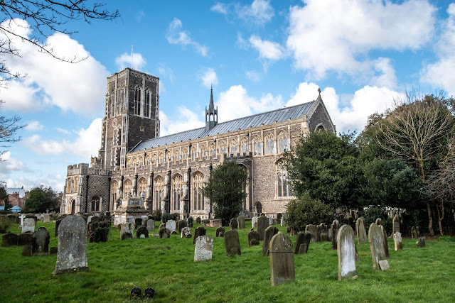
Saint Mary's Church Ingleton - not the most attractive

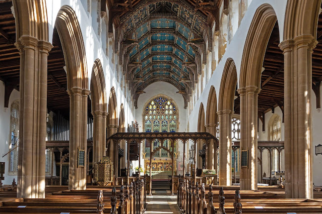
The Church we see today dates only from 1886 but it is possible that there has been a place of worship on the site since the 12th century as the font dates back to Norman times – around 1150. The oldest remaining part of the present Church is the tower of 15th century perpendicular style.
In 1743 the Church was substantially rebuilt when the nave was replaced by an unattractive construction that was referred to as a “barn with mill windows”.
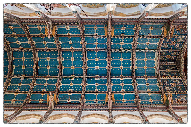
The Ingleton Parish Registers record that almost 450 people were buried inside the Church. Evidence of these burials emerged when over 300 skulls were discovered when the foundations for the present Church were excavated in the 1800s. Many of the memorial floor tablets from inside the old Church were preserved and now lie in parts of the churchyard.
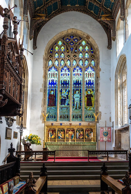
On 18th May 1886 the foundation stone for the new Church was laid. It can be seen outside the Church underneath the East Window. Designed by Cornelius Sherlock of Liverpool and built by John Hewitson, a local builder, the Church is constructed from blue limestone from Skerwith quarry.


We happened to be near the viaduct when a parade of vintage tractors came along the road near us.


Another view over the village with a bridge over river and viaduct in top left corner. Whether you want to walk, cave, rock climb or just look, this is a magical area.


Tuesday, 11 June 2024

Flowers in the landscape - with Gill Moon

This session with Gill was to two locations - both coastal - one to Aldeburgh and the other to Shingle Street. These are two beaches which have a variety of flowers on the beach area and amongs the boats and other paraphernalia. Obviosly, most of the images feature boats, but the flowers are quite spectacular in unexpected places. Hers are a few of my offerings!


These first three show the flowers in the landscape and amongs the general objrcts of the area  ..... generally boats ....


.... but not always!


These two images above show flowers in general patches around the beach.


Other large clumps of flowers are around the sheds and posts etc


All of the above images were taken at Aldeburgh, and those below are from Shingle Street. These lower ones focus on individual flowers.


Bee Orchid. Not too common but a beautiful flower 


Vipers Bugloss and the same below.


Vipers Bugloss 

It was very interesting focusing on the flowers on the beaches because it is not generally an area associated with them.


  Index of posts 

Wednesday, 5 June 2024

Helmingham Hall Gardens - Birthday visit

Helmingham Hall is a spectacular place to visit and I have visited several times. On my birthday, Rosey took me back to wander the beautiful gardens (and buy me lunch!) as a birthday treat - it was lovely. Many events are held here during the year, but just walking around the estate and gardens is well worth a visit.


The moated hall, built in 1510 and still occupied by the the Tollemache family, the family that built it originally.


A couple of the sculptured shrubs in the walled garden


A mass of beautiful Allium


A general view of one of the many pathways


Close up of Allium head


Love In A Mist


Peony


Not sure of the name of this flower


Lovely white roses

All in all a lovely walk around the gardens followed by lunch in the Cafe - thanks Rosey!


Thursday, 30 May 2024

St Edmunds Church, Southwold

Several of these next images were taken on a previous visit but I had forgotten to put them together, so here goes!


Starting with a shot of the whole church. The parish church of Southwold is dedicated to St Edmund, and is considered to be one of Suffolk's finest. It lies under one continuous roof, and was built over about 60 years from the 1430s to the 1490s; it replaced a smaller 13th-century church that was destroyed by fire. The earlier church dated from the time when Southwold was a small fishing hamlet adjacent to the larger Reydon. By the 15th century Southwold was an important town in its own right, and the church was rebuilt to match its power and wealth.

The church is renowned for its East Anglian flushwork, especially that of the tower. Knapped and unknapped flints are arranged in patterns, textures and designs and create the stone work. You live and learn!


The rood screen is considered by many to be the finest in the county. It stretches all the way across the church, and is made up of three separate screens: a rood screen across the chancel arch and parclose screens across the north and south chancel aisles


One of the screens.


All of the church's medieval glass was destroyed by William Dowsing in 1644; the only stained glass windows in the church are the east windows over the altar (1954, by Sir Ninian Comper) and the west window below the grand tower. In World War II the church was narrowly missed by a German bomb that destroyed houses in the nearby Hollyhock Square. The bomb did not do much damage to the building itself but blew out most of the windows - another reason why the church has very little stained glass.


The roof in the chancel is painted and its height gives the church a very open feeling. The roofs were restored in 1857 by Edward Lushington Blackburne and in 1866-1867 by Richard Phipson.


Ornate, but not liked by everybody. I quite like it.


The reredos is by Benedict Williamson - Benedict Williamson (1868–1948) was an architect who designed many Romanesque Revival churches in the United Kingdom who later became a Roman Catholic priest.


A 15th century clock jack stands at the west end. He has an axe and bell which he uses to strike the time, and has a twin at Blythburgh. The Southwold jack is named "Southwold Jack", and is one of the symbols of the Adnams brewery. I had seen the Adnams one but didn`t connect them!


The font has been badly mutilated in the past but is still very impressive with its modern, but large ornate cover.


The two storey south porch has 'M' for St Mary picked out on the lower panels. Above the door, framed by two windows, is a modern statue of St Edmund, shown bound in the ropes that tied him to a tree while he was used by Danish archers as a target.


Wednesday, 29 May 2024

Southwold and Dunwich

Southwold is a lovely coastal town I have visited before but never fully explored. So when a family holiday was proposed, I looked forward to finding out some details and obviouly some photos.
Southwold was mentioned in Domesday Book (1086) as a fishing port. It received its town charter from Henry VII in 1489. The grant of the charter is still marked by the annual Trinity Fair, when it is read out by the Town Clerk. As a town its fortune was directly linked to the neighbouring town of Dunwich, which we also visited during our weeks stay in Southwold.


Gun Hill Green - one of the many `greens` around Southwold.


Nearby Dunwich had, by the thirteenth century, become one of the greatest east coast ports in England and one of the ten largest towns in the country. Its wealth was derived from trade, shipbuilding and the town’s large fishing fleet, due to the large harbour, the “Kings Fleet”, which was sheltered behind a shingle spit extending south from Southwold. However, the east coast was struck by three major storms in 1286 – 87, which extended the spit to block the harbour mouth. This spelled the beginning of the end for Dunwich and the beginning of the rise of Southwold. In 1328, another huge storm struck the Suffolk coast causing the coastal shingle bed to shift. It washed away a significant part of Dunwich town, causing great loss of life and blocking off its harbour completely. Further storms followed in 1347 and 1362. Helped by Southwold and neighbouring Walberswick residents, the Blyth and Dunwich rivers were diverted through a new cut across the shingle spit, north of Dunwich. In parallel to Dunwich’s decline, Southwold began a steady rise in status and in its economy, aided further by a Royal Charter in in 1490 granting them the right to provide safe haven for the King’s ships.


Another major event for Southwold occured on 25th April 1659 when a huge fire devastated the town. It`s economic fortunes fell in 1659 when a fire destroyed most of the town in the space of four hours. The Town Hall and the town records it contained, the market place, prison, shops, granaries and warehouses all went. Three hundred families were made homeless. Many people remained destitute for years, despite charitable donations from all over the country. The town’s famous greens are evidence of early town planning designed to prevent the spread of fire in the future, Gun Hill Green above being an example.


A walk to the south side of Southwold past the beach huts and glorious Foxgloves and arriving at the old harbour area looking across to Walberswick (below)


The ferry point.


On the walk back we saw beautiful stormy skies as above, and of course, more beach huts!


Designed by John Bennett, the award-winning building is owned and run by the Southwold Film Society, a charitable Trust committed to the educational value of film. The primary aim is to recapture the experience of cinema-going in the mid twentieth century, acknowledging that the activity is not just about seeing a film but recognising also that the personnel, environment and programming have an equally important part to play in terms of a “good night out”.  So you will find a commissionaire outside, usherettes, a front of house manager in a DJ, and a “Tiny Wurlitzer” organ rising up mysteriously during the interval.  The National Anthem is played at the end. Brilliant!


Construction of Southwold Lighthouse began in 1887 under the supervision of Sir James Douglass, Engineer in Chief to Trinity House. The lighthouse replaced three local lighthouses which were under threat from severe coastal erosion at Orfordness to the south. While the masonry tower was built a temporary light was shown from a wooden structure which was first lit on 19 February 1889.

The present lighthouse came into operation on 3 September 1890. The light was originally provided by an Argand burner, this was replaced by a Matthews incandescent oil burner in 1906. A Hood 100mm petroleum vapour burner was installed in 1923 and remained until the station was electrified and demanned in 1938. The character and range of Southwold lighthouse were changed in December 2012 with the main light being increased from 17 to 24 Nautical Miles in advance of the decommissioning of Orfordness Lighthouse.


The Southwold Sailors’ Reading Room was built in 1864 as a refuge for fishermen and mariners when not engaged at sea, as an endeavour to keep them out of the pubs and encourage them in Christian ideals.

Displays of a seafaring nature line the walls and fill glass cabinets. Pictures and portraits of local fishermen and seascapes, model ships and maritime paraphernalia offer a fascinating history of Southwold’s connections with the sea.


So next, a walk in Dunwich, which is a fascinating place I always think. I guess its history (above) is the trigger for that feeling.


We walked through Greyfrirs Wood ….


…… past the beautiful Foxgloves ….


 ….. through the ruins of Greyfriars abbey ….


…. Until we came to a solitary grave stone. As it tuns out, the huge collapses of the Dunwich coast and town have left just this last grave stone from the Church. No doubt, coastal erosion will continue in the coming decades and even this, and the ruins will disappear under the sea.


We then walked across the heathlands and finished with a deserved coffee and cake in the coastguarde cottage tearooms.


  Index of posts