Tuesday, 20 June 2023

Exmoor - Minehead

The small port town of Minehead was our destination for today. I have heard of the town in many ways over the years but have never been here. It's a pretty port area with the usual array of small boats which makes a picture!


First image is looking toward the quay area


Looking right from the same vantage point and you can just see (at the top of the image) the marquee of Butlins Holiday Complex. So, it was decided to walk to the quay area


On the way we passed this sculpture to indicate that we were indeed on the West Somerset Coastal Path.


Also, along the promenade, we came across several of these colourful characters indicating the premises nearby. There were some really clever ones I thought. 


I rather liked this one outside a cafe for example.


Approaching the quay with its boats 


The tide was going out leaving patterns in the sand


Many lovely buildings are spread along the promonade


Back at the area where we had parked and started our walk, this clock stood in a square with several sets of Minehead information spread around. Shame I nearly chopped the top off!

We wandered into town and had some lunch before we headed back to Porlock Weir.


Monday, 19 June 2023

Exmoor - Tarr Steps and Dunster

The Tarr Steps is a clapper bridge across the River Barle in the Exmoor National Park. The stone slabs weigh up to two tons each. The bridge is 180 feet (55 m) long and has 17 spans. It has been designated as a Grade I listed building and scheduled monument. It is an ancient form of bridge constructed with large unmortared slabs of stone resting on one another; this is the largest example of its type and is one of the best-known monuments on Exmoor.
Its age is unknown, as several theories claim that Tarr Steps dates from the Bronze Age, but others date them from around 1400 AD. It has been restored several times in recent years, following flood damage.


Tarr Steps

The area around here is beautiful, and the riverside walk was an obvious attraction! It didn't disappoint as it was peaceful and unspoilt.


View of the River Barle as we crossed a bridge to continue our walk back on the other side of the river.


The wire bridge which captures most floating debris in the event of a storm


As we arrived back at the start, this group of young people were crossing and proceeded to sit on a large grass area and resume their schooling. Very nice too!
From here, we drove to Dunster to have a good look round. Leaving the car park, we set of toward the church and arrived at this building which turned out to be an old tithe barn, now used as a wedding and events venue.


The Tithe Barn was originally part of a Benedictine Dunster Priory and has been much altered since the 14th century and only a limited amount of the original features survives.


The Priory Church of St George is predominantly 15th-century with evidence of 12th- and 13th-century work. It was shared for worship between the monks of Dunster Priory and the parishioners, however this led to several conflicts between them. One outcome was the carved rood screen which divided the church in two with, the parish using the west chancel and the monks the east. Strange ways people have!


A dovecote is a structure intended to house pigeons or doves. Dovecotes may be free-standing structures in a variety of shapes or built into the end of a house or barn. They generally contain pigeonholes for the birds to nest. Pigeons and doves were an important food source historically in the Middle East and Europe and were kept for their eggs and dung. A mark of affluence in England in times past.


An old water pump on the side of Parham House, in Dunster. I remember using one of these a lot when I was growing up. 


A restored 18th-century watermill built on the site of a mill mentioned in the Domesday Survey of 1086. The mill is set in peaceful surroundings alongside the river Avill and at the entrance to the Dunster Castle River gardens. The watermill is fully operational. You can often see original milling here and even buy the flour produced. We had a brief wander around but did not stay long as we have looked around similar many times - including in our own village.


Gateway at the side of the mill leading into the castle gardens


Mid/late 18th century picturesque bridge built by HF Luttrell (of Dunster Castle) to replace the medieval mill bridge over River Avill. Built of brick and stone with two pointed arches. Low brick parapet on the south side. Parapet to north side is raised but damaged.

Dunster Castle has been at its commanding location since the Middle Ages: a perfect site for a castle, both visually impressive and easily defended.
The de Mohuns family arrived soon after William the Conqueror became King of England in 1066. William de Mohun constructed a timber castle on the site of a Saxon hillfort as part of the pacification of Somerset.
Nothing remains of the de Mohuns’ castle except the 13th-century lower-level gateway with its massive iron-bound oak doors.
The medieval castle was fortified by a stone curtain wall and bastion towers along the north side of the lower ward.
In 1376 the de Mohuns sold the castle to the Luttrell family, who were responsible for most of what we see at Dunster today. They built the gatehouse in 1420, created a Jacobean mansion in 1617, defended and saved the castle during the English Civil War and updated the castle in the Victorian era.
The family eventually gave the whole castle and grounds to the National Trust who manage it today.


A couple of images of the Castle. One from up in the hillside gardens and the other from ground level and at the front.


The Foresters Arms in Dunster. 


Two of the beautiful buildings around this interesting town.


The Gallox Bridge, Dunster. A medieval packhorse bridge that has been in use for over 500 years. The bridge was probably built in the 15th century and was used by shepherds bringing wool fleeces from the high moors of Exmoor to the busy wool market in Dunster. The name ‘Gallox’ comes from ‘gallows’, a reference to a place of public execution on a hill outside the village, where the lords of Dunster Castle would hang thieves.


Sunday, 18 June 2023

Exmoor - Porlock Weir

On our way to our holiday accommodation in Porlock Weir, we stopped in Porlock itself for groceries etc. This was another small Somerset village where the pace of life appears much slower than what we are used to in Suffolk - which is itself reasonably chilled out!

The house was brilliant! The travel firm's description really summed it up: Garden View is a comfortable, spacious ground-floor apartment, within the west wing of a beautiful Edwardian hunting lodge, Porlock Vale House. There is an enclosed and private garden directly outside the property with stunning views across the fields to the sea.

From the rear view below, taken from the beach, our accommodation was on the ground floor of Porlock Vale House, on the right-hand side - all in all, a lovely spot.


Garden View from the beach looking over the horse paddock.


The beach from which I took the above photo. This one above looks toward the Weir end of Porlock Weir.


The bottom of the garden, looking toward the beach over the paddocks.

Porlock Weir itself is a harbour settlement approximately 1.5 miles (2.4 km) west of the inland village of Porlock, Somerset. Like most ports in West Somerset, the harbour is tidal and is home to a small flotilla of yachts and is visited by many more in spring and summer. 
The port has existed for more than a thousand years. The Anglo-Saxon Chronicle reports that in 1052 Harold Godwinson came from Ireland with nine ships and plundered the area and before that in 866 AD it was raided by Danes. In the 18th and 19th centuries coal from South Wales was the main cargo.


Tide in ....


Tide out.


Just loved this row of cottages on the harbour side. I believe they are called Gibraltar Cottages and are mainly 17th century.


View along the beach further, toward Gore Point

The Ship Inn at Porlock Weir. We had a great lunch here on Sunday

The Ship Inn, known colloquially as The Top Ship, dates back to at least the 15th Century, making it possibly one of the oldest inns in the country. It is believed that even before that date some sort of hostelry existed on the site. It is an establishment that boasts a long and varied history from ties to smuggling, visits from a Poet Laureate and as an invaluable part in the long and arduous journey by horse-drawn coach to and from Lynmouth.

When the pub became The Ship Inn, geographically Porlock was quite different to it is now, the marshes north of the village were underwater as the Bristol Channel came up to where the village school now stands. This meant The Ship Inn was situated very close to the shoreline- an ideal spot for smuggling, or Free Trade as it was known! It is rumoured that at least one secret tunnel exists, linking the Inn to a nearby cottage: useful for bringing in stock or getting rid of contraband when the excise men came knocking! During the reign of King Charles II the smuggling in Somerset became so notorious that His Majesty’s Surveyor-General of Customs, William Culliforde, visited the county. In 1682 The Ship was a venue for a clandestine meeting between smugglers and a corrupt revenue officer. The story leaked out and the revenue officer stood trial.


Another old, thatched property in the street.


The remains of two lime kilns are visible as brick arched recesses incorporated into a house known as 'The Kiln'. They were first noted on the 1903 Ordnance Survey map and are therefore fairly recent in date.

So, this was our base area for some exploration of Exmoor - or part of it at least.


  Index of posts 

Saturday, 17 June 2023

Exmoor - Nether Stowey & The Great Wood

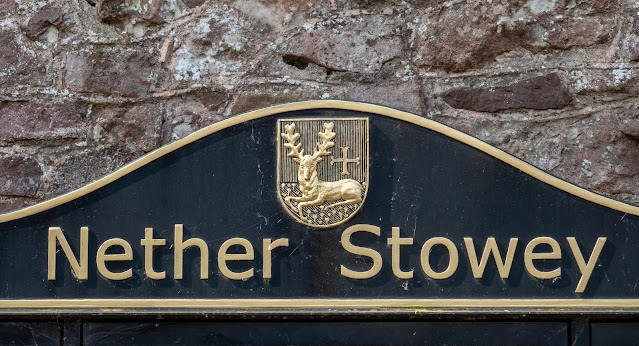
We had not explored the beautiful area of Exmoor before, so this was a much-anticipated holiday. Having broken our journey with an overnight stop, we journeyed on toward our destination on Saturday morning with time to stop and explore other places - the first being Nether Stowey, briefly the home of Samual Coleridge, poet, and author of The Rime of the Ancient Mariner.
Nether Stowey is known as the Gateway to the Quantock Hills.


The plaque on the wall of Coleridge's cottage. We didn't go in but took the picture!

Samuel Taylor Coleridge was (born on 21 October 1772 and died 25 July 1834) was an English poet, literary critic, philosopher, and theologian who, with his friend William Wordsworth, was a founder of the Romantic Movement in England and a member of the Lake Poets. He also shared volumes and collaborated with Charles Lamb, Robert Southey, and Charles Lloyd.
He wrote the poems The Rime of the Ancient Mariner (I did this one at school!) and Kubla Khan, as well as the major prose work Biographia Literaria. His critical work, especially on William Shakespeare, was highly influential.
Throughout his adult life, Coleridge had crippling bouts of anxiety and depression; it has been speculated that he had bipolar disorder, which had not been defined during his lifetime. He was physically unhealthy, which may have stemmed from a bout of rheumatic fever and other childhood illnesses. He was treated for these conditions with laudanum, which fostered a lifelong opium addiction.

It`s amazing that a man held in such high esteem, in his lifetime and still today, should have produced what he did under such difficult conditions which lasted all his life.


Nether Stowey is a pretty Somerset village with a stream flowing through the street.

Then we journeyed on through what is known as the Great Wood. Some of the following images were taken a few days later when we returned briefly to the area.


The beautiful shapes of the trees and the light and shade along the pathways - magical!


Other eye-catching sights are the huge ants' nests in the area.


- and then of course, what visit would be complete without a view of the Exmoor ponies? We had started to walk away from the car when I remembered something, and I returned to find the ponies licking the car for some reason! They had just appeared from amongst the trees as they were not in sight as we arrived.


Dead Woman's Ditch is an earthwork which has been scheduled as an ancient monument. It is a linear earthwork consisting of a bank with a ditch along the west side running for approximately 950 metres (3,120 ft). The earthwork is presumed to be of prehistoric origin and is of unknown purpose.
The 1 kilometre (0.62 mi) long earthwork has been cut through by later tracks and a road. It is badly eroded in places.
Dead Woman's Ditch is sometimes associated with the murder of Jane Walford by her husband John in 1789 but the name predates the murder, appearing on an earlier map.

So far so good - now to drive to our holiday let in Porlock Weir.